
Image: Struve Geodetic Arc-fr

Size of this PNG preview of this SVG file: 543 × 599 pixels. Other resolution: 217 × 240 pixels.
Original image (SVG file, nominally 975 × 1,076 pixels, file size: 657 KB)
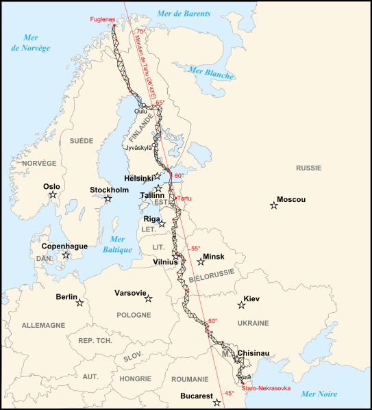
Description: Map of the Struve Geodetic Arc. The 34 red points are the places registered in the UNESCO World Heritage Site
Title: Struve Geodetic Arc-fr
Credit: Image:Map of the Struve Geodetic Arc.jpg by Badock
Author: historicair 23:58, 13 September 2007 (UTC)
Permission: You may select the license of your choice.
Usage Terms: Creative Commons Attribution-Share Alike 3.0
License: CC BY-SA 3.0
License Link: http://creativecommons.org/licenses/by-sa/3.0/
Attribution Required?: Yes
Image usage
The following page links to this image:

All content from Kiddle encyclopedia articles (including the article images and facts) can be freely used under Attribution-ShareAlike license, unless stated otherwise.