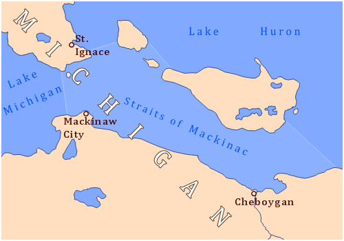
Image: Straits of Mackinac map
Straits_of_Mackinac_map.png (500 × 350 pixels, file size: 97 KB, MIME type: image/png)
Description: Map of the Straits of Mackinac, located between the two major landmasses that make up the U.S. state of Michigan, the Upper Peninsula to the north (top) and the Lower Peninsula to the south (bottom), and flowing between Lake Michigan and Lake Huron,or alternatively, when Lakes Michigan and Huron are viewed as being one lake, flowing between the two lobes of Lake Michigan–Huron.
Title: Straits of Mackinac map
Credit: Own work
Author: Drdpw
Usage Terms: Creative Commons Attribution-Share Alike 3.0
License: CC BY-SA 3.0
License Link: https://creativecommons.org/licenses/by-sa/3.0
Attribution Required?: Yes
Image usage
The following page links to this image:

All content from Kiddle encyclopedia articles (including the article images and facts) can be freely used under Attribution-ShareAlike license, unless stated otherwise.

