
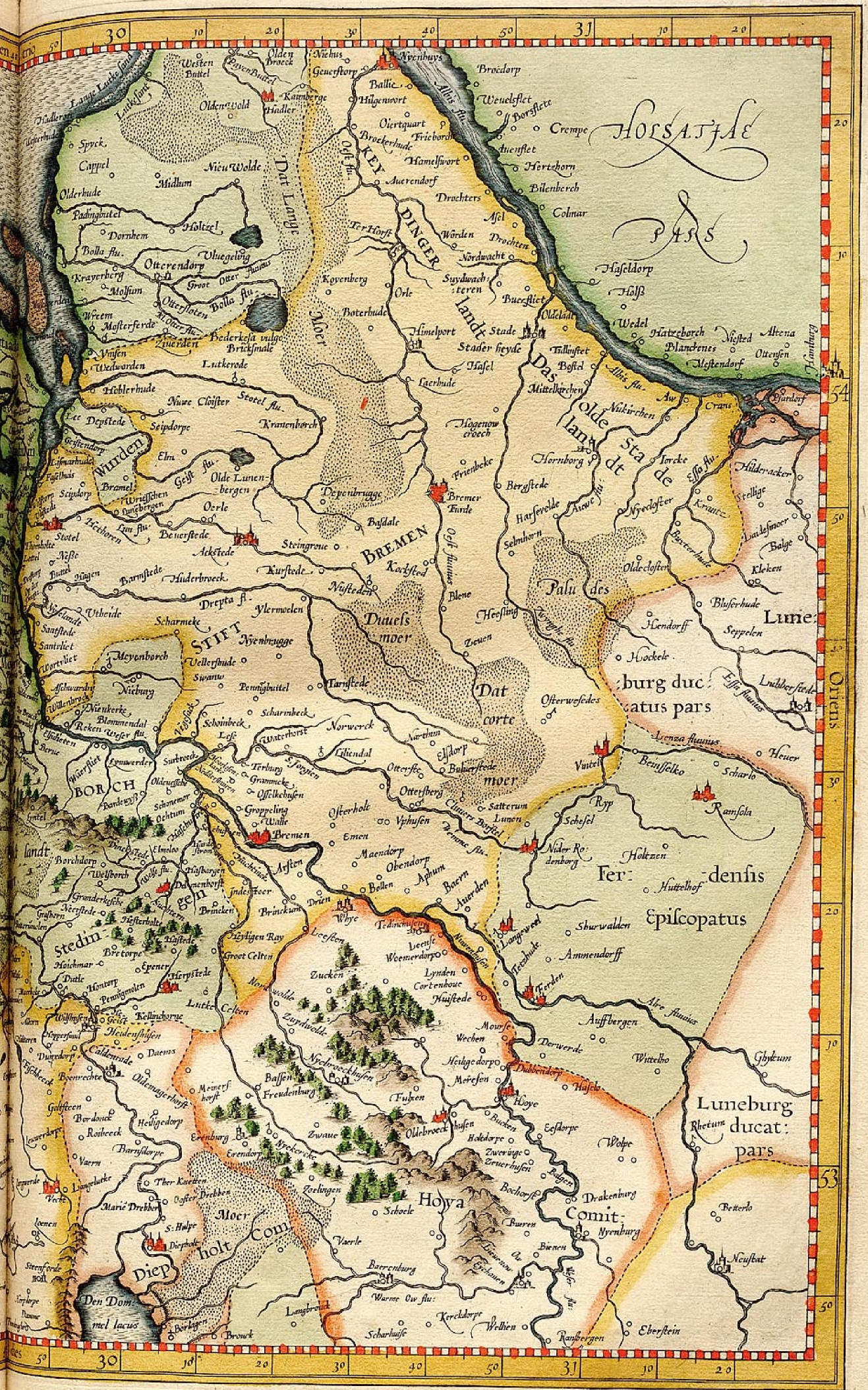
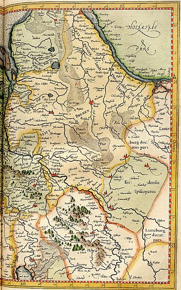
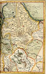
Image: Stift Bremen, Atlas Cosmographicae (Mercator)
Description: Cropping of a plate from Gerardus Mercator's Atlas Cosmographicae (1595) showing the Prince-Archbishopric of Bremen ("Stift Bremen", in yellow) on the west bank of the Elbe River. In the late 16th century when this map was drawn, the Prince-Archbishopric was ruled by Protestants administrators. The Archdiocese of Bremen was much larger while the city of Bremen proper was a self-ruling free imperial city. The Prince-Bishopric of Verden ("Ferdensis Episcopatus", in green) is shown to the southeast of the Prince-Archbishopric of Bremen.
Title: Stift Bremen, Atlas Cosmographicae (Mercator)
Credit: Atlas Cosmographicae, etc., Gerardus Mercator
Author: Gerardus Mercator
Usage Terms: Public domain
License: Public domain
Attribution Required?: No
Image usage
The following page links to this image:

.jpg)