Image: State water project

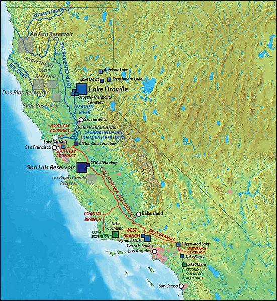
Description: Map of the w:California State Water Project (SWP). Blue squares: existing SWP reservoirs Red lines: existing SWP canals, tunnels and aqueducts Blue lines: rivers and natural waterways Dark blue squares: SWP reservoirs shared with w:Central Valley Project Light gray squares and lines: Unbuilt reservoirs and canals originally planned under SWP Green squares and lines: Non-SWP distribution infrastructure supplied by SWP water
Title: State water project
Credit: Shaded relief data from DEMIS Mapserver (Public Domain); drawn in Adobe Illustrator by me
Author: Shannon1
Usage Terms: GNU Free Documentation License
License: GFDL
License Link: http://www.gnu.org/copyleft/fdl.html
Attribution Required?: Yes
Image usage
The following page links to this image:

