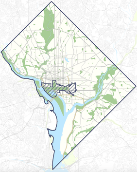
Image: State of Washington, DC Boundaries
State_of_Washington,_DC_Boundaries.png (282 × 353 pixels, file size: 66 KB, MIME type: image/png)
Description: This map shows the proposed boundaries of the State of Washington, DC.
Title: State of Washington, DC Boundaries
Credit: Original publication: http://statehood.dc.gov Immediate source: statehood.dc.gov
Author: Government of the District of Columbia Office of Planning
Usage Terms: Fair use of copyrighted material in the context of District of Columbia statehood referendum, 2016
License: Fair use
License Link: //en.wikipedia.org/wiki/File:State_of_Washington,_DC_Boundaries.png
Image usage
The following page links to this image:

All content from Kiddle encyclopedia articles (including the article images and facts) can be freely used under Attribution-ShareAlike license, unless stated otherwise.

