
Image: Stairs Expedition Map lo-res
Size of this preview: 615 × 599 pixels. Other resolutions: 246 × 240 pixels | 699 × 681 pixels.
Original image (699 × 681 pixels, file size: 105 KB, MIME type: image/jpeg)
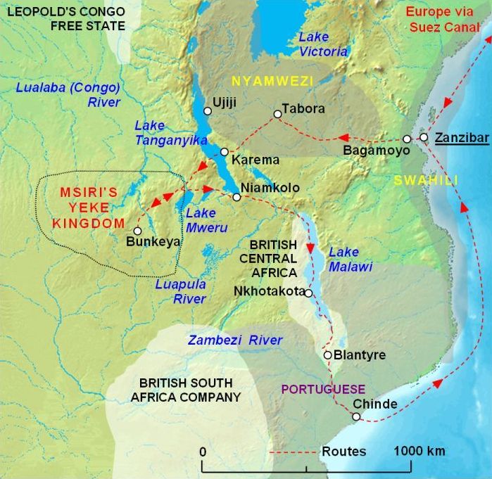
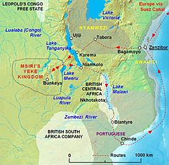
Description: Map of the route of the Stairs Expedition to Katanga, Congo, Central Africa in 1891–2. Borders of Msiri's Kingdom and other territories are approximate. Owing to a civil war, Msiri was not in control of all his kingdom's lands at the time of the expedition.
Title: Stairs Expedition Map lo-res
Credit: Own work
Author: Rexparry sydney
Usage Terms: Creative Commons Attribution-Share Alike 3.0
License: CC BY-SA 3.0
License Link: http://creativecommons.org/licenses/by-sa/3.0/
Attribution Required?: Yes
Image usage
The following page links to this image:

All content from Kiddle encyclopedia articles (including the article images and facts) can be freely used under Attribution-ShareAlike license, unless stated otherwise.