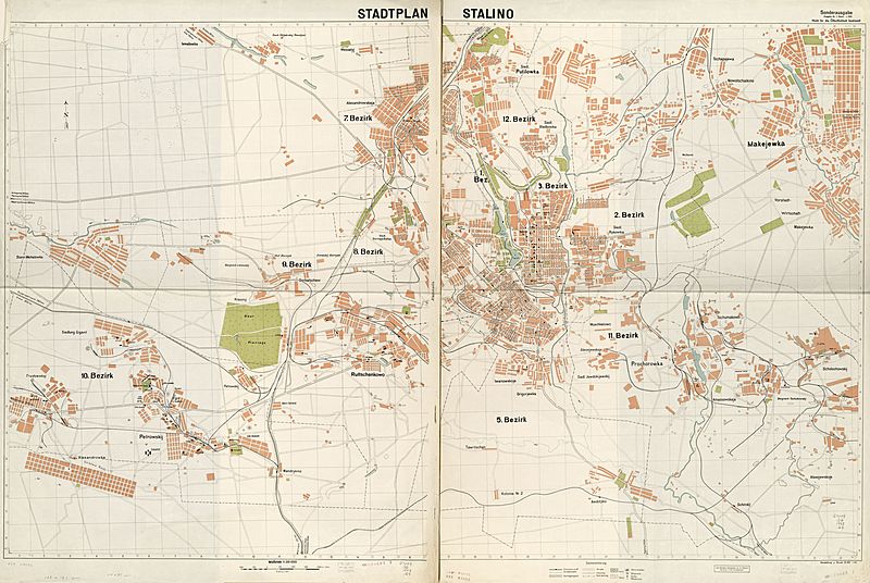
Image: Stadtplan Stalino LOC 2012593213

Description: "Stand: 1. 1943." Also shows numbered administrative wards (Bezirke). Unidentified grid. Former security restriction in upper margin: Nicht für die Öffentlichkeit bestimmt! Printed in western/eastern segments. Available also through the Library of Congress Web site as a raster image. Includes note. LC copy imperfect: Use-worn, fold-lined, rubber-stamped.
Title: Stadtplan Stalino LOC 2012593213
Credit: https://www.loc.gov/item/2012593213/
Author: Germany. Heer. D. 415
Permission: This map is available from the United States Library of Congress's Geography & Map Division under the digital ID g7104d.ct003171. This tag does not indicate the copyright status of the attached work. A normal copyright tag is still required. See Commons:Licensing for more information.
Usage Terms: Public domain
License: Public domain
Attribution Required?: No
Image usage
The following page links to this image:

