
Image: Spinosaur Taxonomy Map

Size of this preview: 800 × 399 pixels. Other resolutions: 320 × 160 pixels | 4,400 × 2,194 pixels.
Original image (4,400 × 2,194 pixels, file size: 2.21 MB, MIME type: image/png)
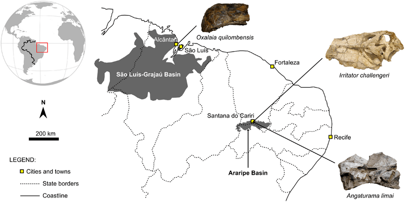
Description: Map of northeastern Brazil showing the location of the Araripe and São Luís-Grajaú basins. The (likely) provenance of the holotypes of local spinosaurid taxa is indicated.
Title: Spinosaur Taxonomy Map
Credit: http://journals.plos.org/plosone/article?id=10.1371/journal.pone.0187070
Author: Marcos A. F. Sales, Cesar L. Schultz
Usage Terms: Creative Commons Attribution 4.0
License: CC BY 4.0
License Link: https://creativecommons.org/licenses/by/4.0
Attribution Required?: Yes
Image usage

All content from Kiddle encyclopedia articles (including the article images and facts) can be freely used under Attribution-ShareAlike license, unless stated otherwise.