
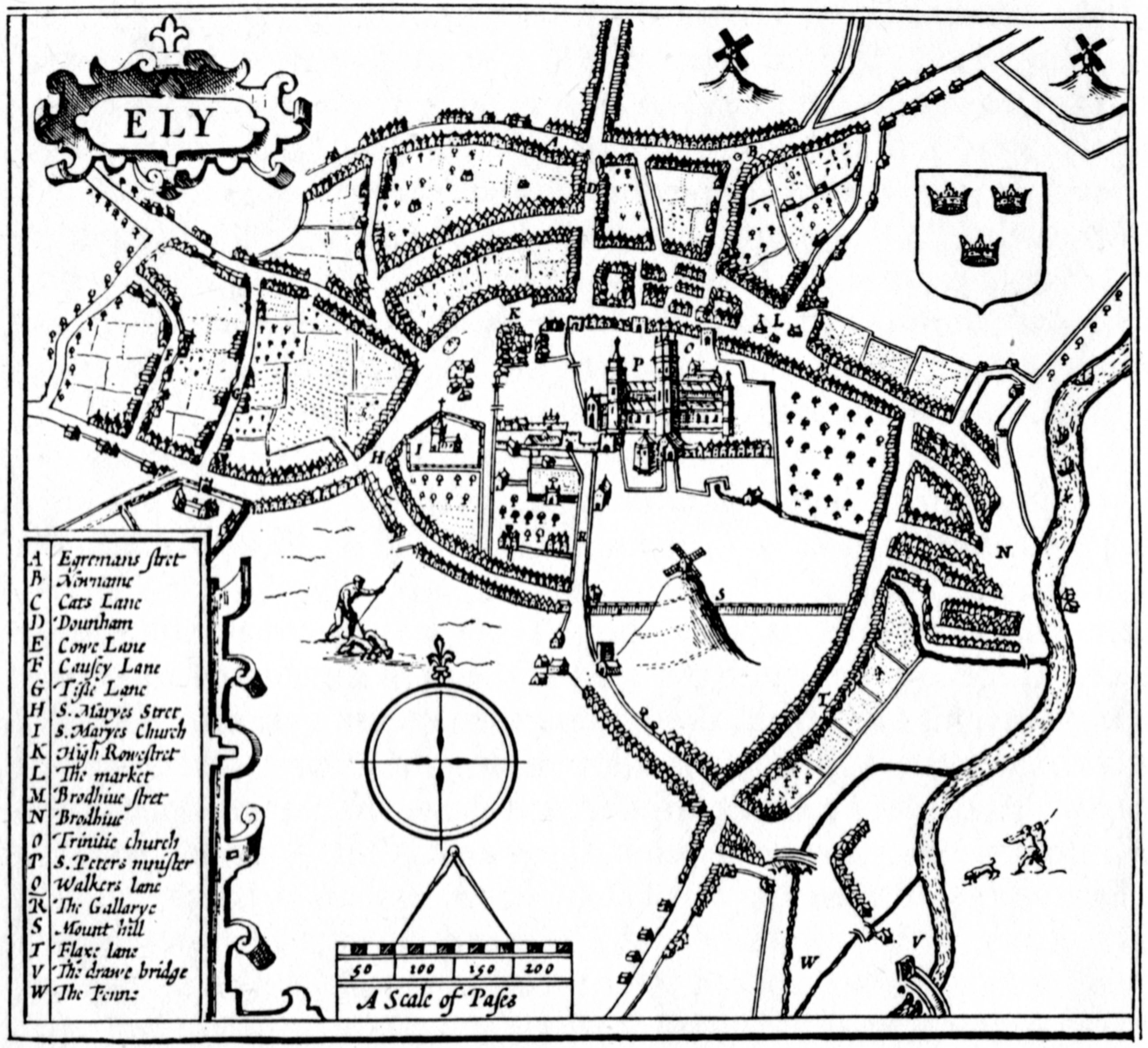
Image: Speeds plan of Ely 1610 from Dorman 1986
Size of this preview: 657 × 600 pixels. Other resolutions: 263 × 240 pixels | 2,598 × 2,371 pixels.
Original image (2,598 × 2,371 pixels, file size: 716 KB, MIME type: image/jpeg)
Description: A plan of Ely from Dorman (1986) The story of Ely p. 54 which is originally from the top right hand corner of John Speed's 1610 map of Huntingdonshire
Title: Speeds plan of Ely 1610 from Dorman 1986
Credit: Dorman B E, (1986) The story of Ely, p. 54. This image has been compared with John Speed proof maps - Atlas.2.61.1 and determined to be non derivative
Author: John Speed 1610 non derivative
Usage Terms: Public domain
License: Public domain
Attribution Required?: No
Image usage
The following page links to this image:

All content from Kiddle encyclopedia articles (including the article images and facts) can be freely used under Attribution-ShareAlike license, unless stated otherwise.