
Image: Spatial distribution of rice, millet and mixed farming sites with a boundary of rice and millet and possible centers of agriculture
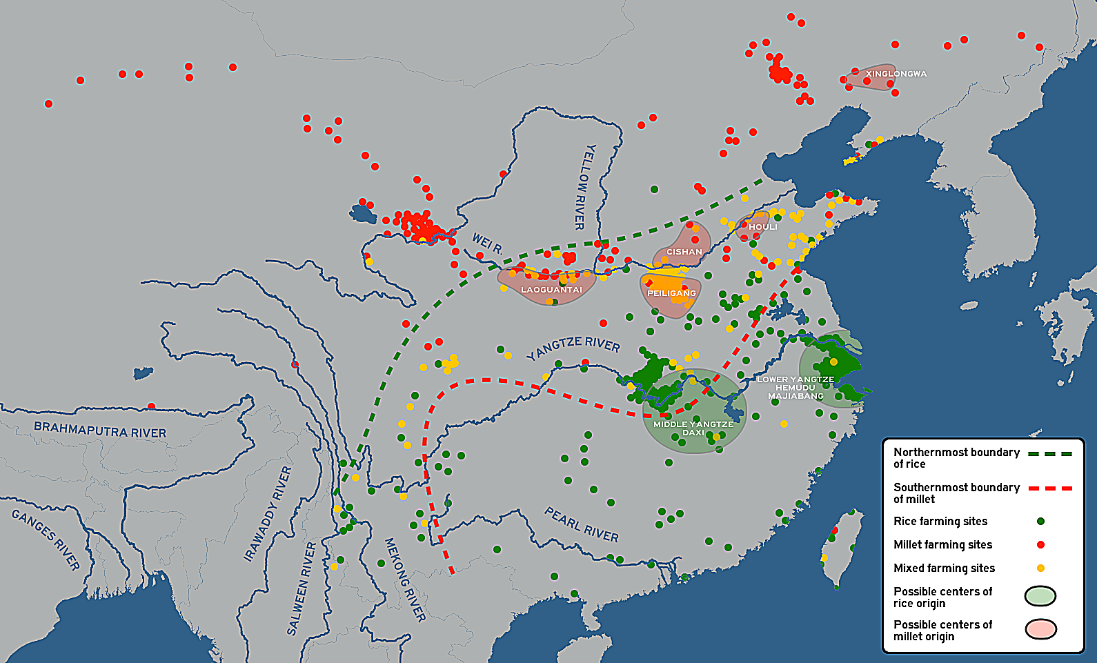
Description: Spatial distribution of rice, millet and mixed farming sites with a boundary of rice and millet and possible centers of agriculture. Per: He, Keyang; Lu, Houyuan; Zhang, Jianping; Wang, Can; Huan, Xiujia (7 June 2017). "Prehistoric evolution of the dualistic structure mixed rice and millet farming in China". The Holocene. 27 (12): 1885–1898. doi:10.1177/0959683617708455.
Title: Spatial distribution of rice, millet and mixed farming sites with a boundary of rice and millet and possible centers of agriculture
Credit: Own work; Based on File:Blank map world rivers.svg by User:丁志仁
Author: Obsidian Soul
Usage Terms: Creative Commons Zero, Public Domain Dedication
License: CC0
License Link: http://creativecommons.org/publicdomain/zero/1.0/deed.en
Attribution Required?: No
Image usage
The following 4 pages link to this image:
