
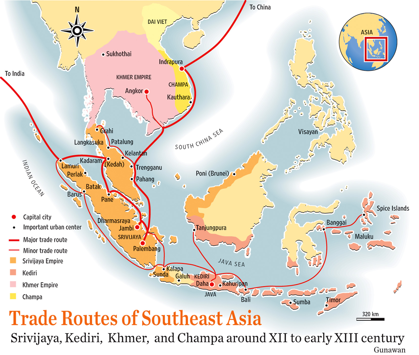
Image: Southeast Asia trade route map XIIcentury
Size of this preview: 706 × 599 pixels. Other resolutions: 283 × 240 pixels | 1,696 × 1,440 pixels.
Original image (1,696 × 1,440 pixels, file size: 521 KB, MIME type: image/jpeg)
Description: Trade route map of Southeast Asia around 12th to early 13th century AD
Title: Southeast Asia trade route map XIIcentury
Credit: self-made, based from "Atlas Sejarah Indonesia dan Dunia" (Indonesian and World Historical Atlas) page 32, Drs. Achmad Jamil, Yulia Darmawaty, S.Pd, Sri Wachyuni, S.Pd, Mastara, Jakarta 2004
Author: Gunawan Kartapranata
Usage Terms: Creative Commons Attribution-Share Alike 4.0
License: CC BY-SA 4.0
License Link: https://creativecommons.org/licenses/by-sa/4.0
Attribution Required?: Yes
Image usage
The following page links to this image:

All content from Kiddle encyclopedia articles (including the article images and facts) can be freely used under Attribution-ShareAlike license, unless stated otherwise.