
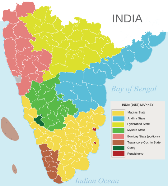
Image: South Indian territories

Size of this PNG preview of this SVG file: 540 × 599 pixels. Other resolution: 216 × 240 pixels.
Original image (SVG file, nominally 672 × 746 pixels, file size: 306 KB)
Description: South Indian states prior to the States Reorganisation Act (1956)
Title: South Indian territories
Credit: Own work based on: Hyderabad state 1909.jpg, Bombay Prov south 1909.jpg and Plate 34. Sect. XIII- Madras, Mysore and Goa maps from Constable 1893 Hand Atlas.jpg Map of Indian states/territories in 1947: Map on Terra.es (archived version) States Reorganisation Act (1956) - First Schedule, Articles 1 & 4 for detailed transfer of territories between provinces and states
Author: AreJay
Permission: GFDL, CC-Attrib
Usage Terms: Creative Commons Attribution 3.0
License: CC BY 3.0
License Link: https://creativecommons.org/licenses/by/3.0
Attribution Required?: Yes
Image usage
The following 2 pages link to this image:

All content from Kiddle encyclopedia articles (including the article images and facts) can be freely used under Attribution-ShareAlike license, unless stated otherwise.