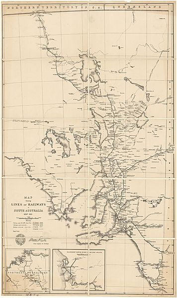
Image: South Australia railway lines map, November 1910

Size of this preview: 356 × 599 pixels. Other resolutions: 142 × 240 pixels | 5,000 × 8,419 pixels.
Original image (5,000 × 8,419 pixels, file size: 18.69 MB, MIME type: image/jpeg)
Description: Map of railways extant and proposed in 1910 in South Australia
Title: South Australia railway lines map, November 1910
Credit: http://nla.gov.au/nla.obj-234151847/download?downloadOption=zip&firstPage=0&lastPage=0 Map shewing lines of railways in South Australia, Novr. 1910[1], Surveyor General's Office, 1910
Author: Vaughan, A., South Australia. Surveyor-General's Office
Usage Terms: Public domain
License: Public domain
Attribution Required?: No
Image usage
The following image is a duplicate of this image (more details):
The following page links to this image:

All content from Kiddle encyclopedia articles (including the article images and facts) can be freely used under Attribution-ShareAlike license, unless stated otherwise.
