
Image: SouthIsland rrMap v02

Size of this PNG preview of this SVG file: 446 × 599 pixels. Other resolution: 178 × 240 pixels.
Original image (SVG file, nominally 744 × 1,000 pixels, file size: 70 KB)
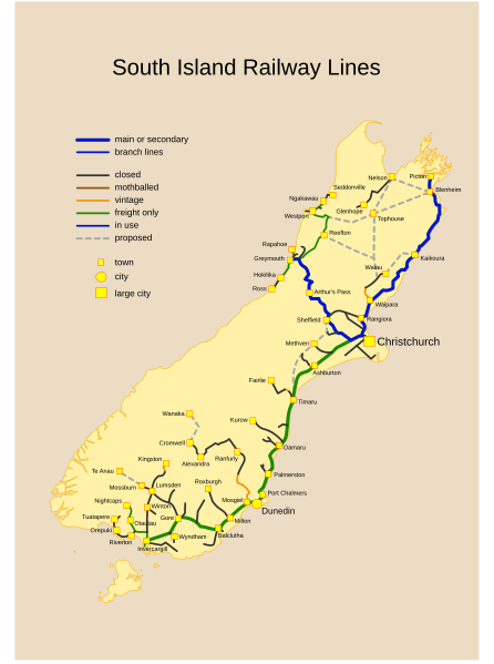
Description: Past, Current and Proposed Railways of NZ South Island. Viewers might need an SVG capable browser to see this map in full size.
Title: SouthIsland rrMap v02
Credit: Starting source map (landmass and railways) before refinement and simplification from: www.demis.nl
Author: Manu3d at English Wikipedia (Original text: Emanuele D'Arrigo)
Usage Terms: Public domain
License: Public domain
Attribution Required?: No
Image usage
The following 2 pages link to this image:

All content from Kiddle encyclopedia articles (including the article images and facts) can be freely used under Attribution-ShareAlike license, unless stated otherwise.