
Image: South-Pangong-LSIB-vs-Chinese-claims

Size of this preview: 800 × 552 pixels. Other resolutions: 320 × 221 pixels | 950 × 656 pixels.
Original image (950 × 656 pixels, file size: 295 KB, MIME type: image/png)
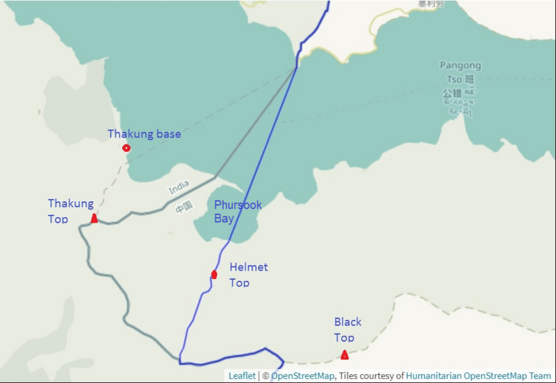
Description: The map depicts of the Line of Actual Control (LAC) south of the Pangong Lake, marked by the US Office of Geographer in 2013 and 2017 (in blue) and the LAC in effect in July 2020 marked by the OpenStreetMap (in green); the faint line represents Chinese attempts to establish a new line in 2020
Title: South-Pangong-LSIB-vs-Chinese-claims
Credit: https://earthworks.stanford.edu/catalog/stanford-yg089df0008
Author: United States Office of Geographer, Stanford University, OpenStreetMap
Usage Terms: Public domain
License: Public domain
Attribution Required?: No
Image usage
The following page links to this image:

All content from Kiddle encyclopedia articles (including the article images and facts) can be freely used under Attribution-ShareAlike license, unless stated otherwise.