
Image: Socsksargen

Size of this preview: 507 × 600 pixels. Other resolutions: 203 × 240 pixels | 1,846 × 2,183 pixels.
Original image (1,846 × 2,183 pixels, file size: 475 KB, MIME type: image/png)
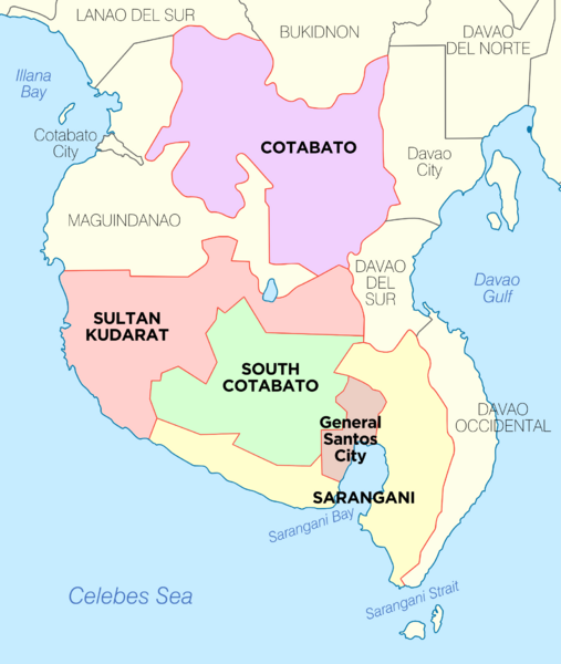
Description: Political Map of Socsksargen Region, Philippines. Showing Cotabato, Sarangani, South Cotabato, Sultan Kudarat and General Santos City. Used:PhlMapCit.svg by Felipe_Aira and Philippines location map.svg by NordNordWest
Title: Socsksargen
Credit: Own work
Author: Exec8
Usage Terms: Creative Commons Attribution-Share Alike 4.0
License: CC BY-SA 4.0
License Link: https://creativecommons.org/licenses/by-sa/4.0
Attribution Required?: Yes
Image usage
The following page links to this image:

All content from Kiddle encyclopedia articles (including the article images and facts) can be freely used under Attribution-ShareAlike license, unless stated otherwise.