
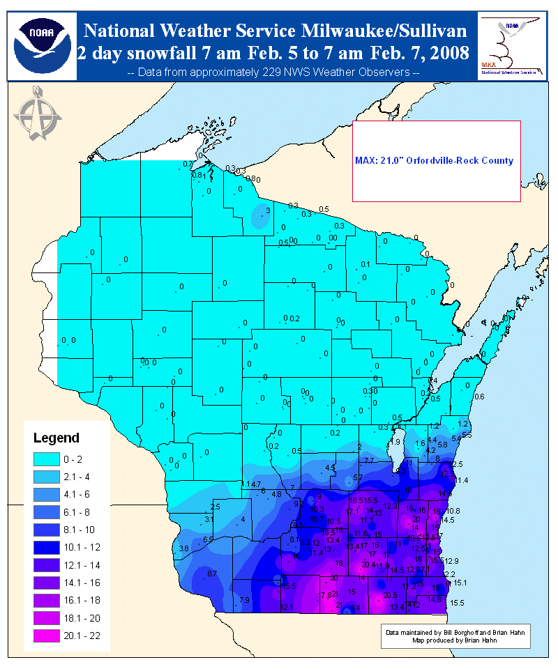
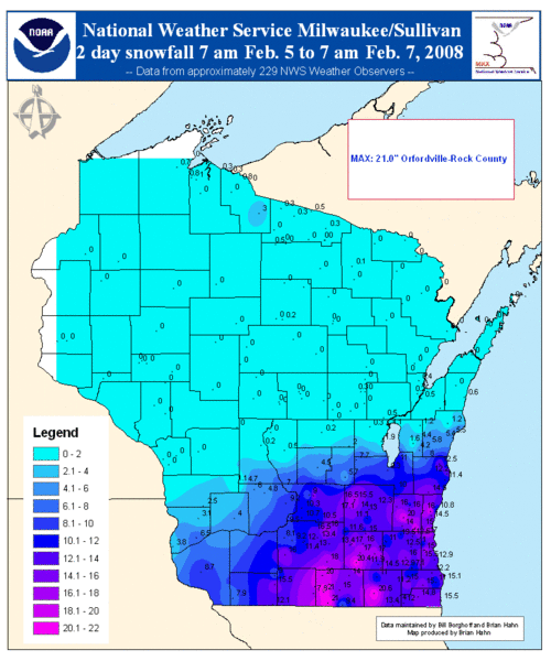
Image: Snowfall amounts Wisconsin Feb 5-6
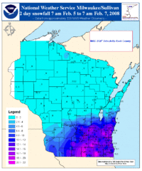
Size of this preview: 500 × 600 pixels. Other resolutions: 200 × 240 pixels | 800 × 960 pixels.
Original image (800 × 960 pixels, file size: 74 KB, MIME type: image/gif)
Description: Map of snowfall amounts across Wisconsin during a winter storm event on February 5-6, 2008 which was associated with the system that spawned a tornado outbreak over the Mid-Mississippi, Ohio and Tennessee Valleys at the same time.
Title: Snowfall amounts Wisconsin Feb 5-6
Credit: Own work
Usage Terms: Public domain
License: Public domain
Attribution Required?: No
Image usage
The following page links to this image:

All content from Kiddle encyclopedia articles (including the article images and facts) can be freely used under Attribution-ShareAlike license, unless stated otherwise.