Image: Sn-growth

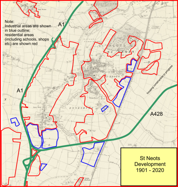
Description: Map showing the growth oif the built-up area of St Neots. The base map is from 1901, and the coloured outlines show the extent of the built up area in 2020; red is housing, including schools, shops, hotels and restaurants. The blue area shows industrial use.
Title: Sn-growth
Credit: The base map is an Ordnance Survey six inch map composite dated 1901. The mapping itself is copyright-excpired, but the digitisation is copyright of the National Library of Scotland. They grant non-commecial reproduction rights CC-by-NC-SA 4.0. The rest of the image is my personal work.
Author: National Library of Scotland as described above.
Usage Terms: Creative Commons Attribution-Share Alike 4.0
License: CC BY-SA 4.0
License Link: https://creativecommons.org/licenses/by-sa/4.0
Attribution Required?: Yes
Image usage
The following page links to this image:

