
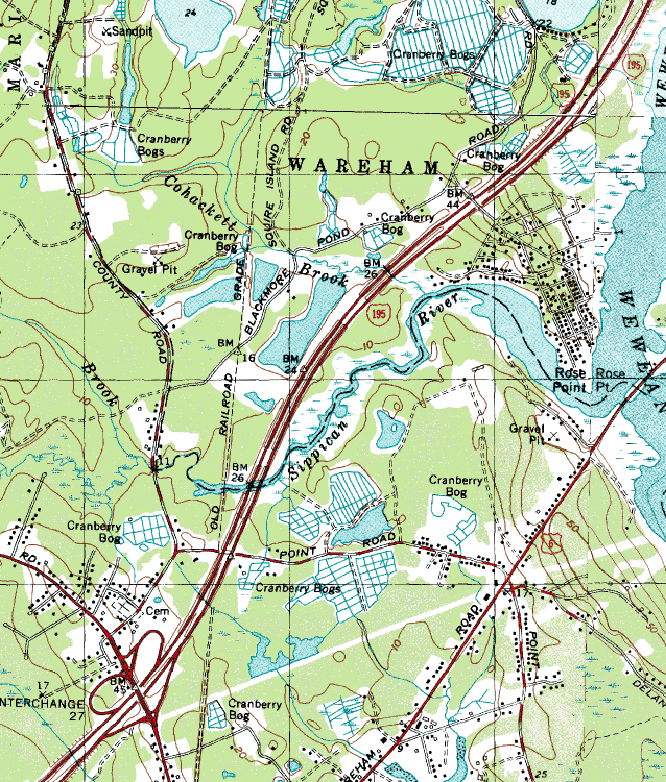
Image: Sippican River, Massachusetts (lower river)
Size of this preview: 510 × 599 pixels. Other resolutions: 204 × 240 pixels | 666 × 782 pixels.
Original image (666 × 782 pixels, file size: 213 KB, MIME type: image/png)
Description: Map of Sippican River, Massachusetts, USA. Lower section of river. Sippican River Marshes, USGS Marion (MA) Topographic Map.
Title: Sippican River, Massachusetts (lower river)
Credit: United States Geological Survey.
Author: United States Geological Survey, United States Department of the Interior.
Permission: Public domain (original work of the US Federal Government).
Usage Terms: Public domain
License: Public domain
Attribution Required?: No
Image usage
The following page links to this image:

All content from Kiddle encyclopedia articles (including the article images and facts) can be freely used under Attribution-ShareAlike license, unless stated otherwise.
.png)