
Image: Silver firs boundary (2)

Size of this PNG preview of this SVG file: 671 × 599 pixels. Other resolution: 269 × 240 pixels.
Original image (SVG file, nominally 1,397 × 1,248 pixels, file size: 1.16 MB)
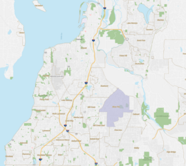
Description: A map of the Silver Firs CDP, Washington boundary. Based on data from https://data.census.gov/map?q=Silver+Firs+CDP,+Washington&layer=VT_2020_160_00_PY_D1&basemap=detailed&palette=Purples&mode=thematic&loc=47.8619,-122.1424,z13.3696
Title: Silver firs boundary (2)
Credit: Own work
Author: Pyro789x
Usage Terms: Creative Commons Attribution-Share Alike 4.0
License: CC BY-SA 4.0
License Link: https://creativecommons.org/licenses/by-sa/4.0
Attribution Required?: Yes
Image usage
The following page links to this image:

All content from Kiddle encyclopedia articles (including the article images and facts) can be freely used under Attribution-ShareAlike license, unless stated otherwise.
.svg)