
Image: Sidney Perley 1912 Map of Essex County Indian Deeds
No higher resolution available.
Sidney_Perley_1912_Map_of_Essex_County_Indian_Deeds.png (649 × 436 pixels, file size: 197 KB, MIME type: image/png)
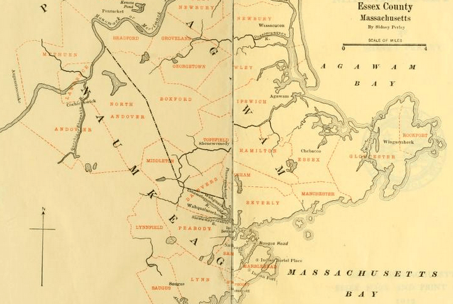
Description: Detail from Sidney Perley's 1912 collection of original Essex County, Massachusetts Indian deeds showing his estimate of pre-contact Naumkeag territory based on the towns receiving their deeds from Naumkeag descendants. Note that this map does include Naumkeag territories to the west and south in Middlesex and Suffolk county.
Title: Sidney Perley 1912 Map of Essex County Indian Deeds
Credit: Own work
Author: Bargsnaffle
Usage Terms: Creative Commons Attribution-Share Alike 4.0
License: CC BY-SA 4.0
License Link: https://creativecommons.org/licenses/by-sa/4.0
Attribution Required?: Yes
Image usage
The following page links to this image:

All content from Kiddle encyclopedia articles (including the article images and facts) can be freely used under Attribution-ShareAlike license, unless stated otherwise.