
Image: Shropshire1832 Map
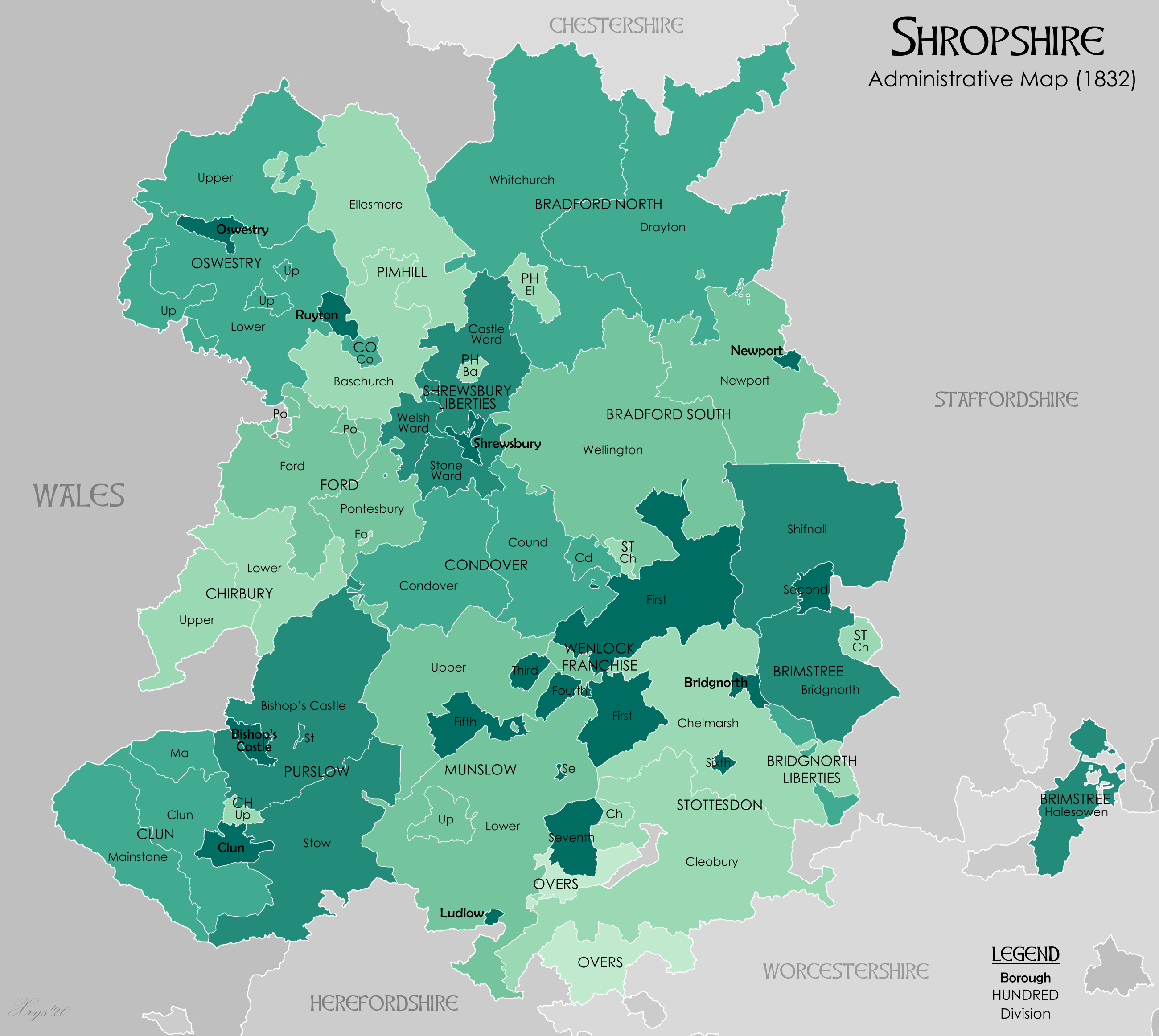
Description: English: English: Administrative map of Shropshire in 1832 showing Hundreds. Also showing extant Boroughs. Hundred boundaries from The Shropshire Gazetteer, Gregory (1924). Source data for parish boundaries - Kain, R.J.P., and Oliver, R.R. (2001) "Historic parishes of England and Wales". Unit names and Borough Boundaries from Vision of Britain website and The First Report of the Commissioners Appointed to Inquire into the Municipal Boundaries in England and Wales, Part III, NORTHERN CIRCUITS (1835)
Title: Shropshire1832 Map
Credit: Own work
Author: XrysD
Usage Terms: Creative Commons Attribution-Share Alike 4.0
License: CC BY-SA 4.0
License Link: https://creativecommons.org/licenses/by-sa/4.0
Attribution Required?: Yes
Image usage
The following page links to this image:
