
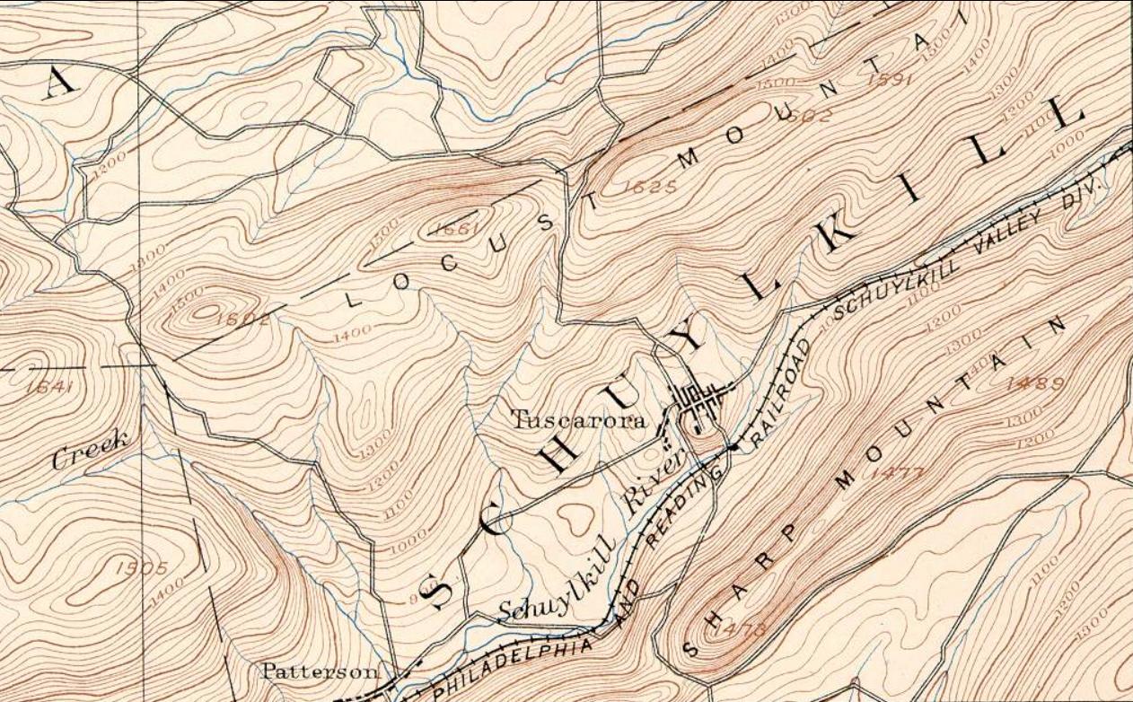
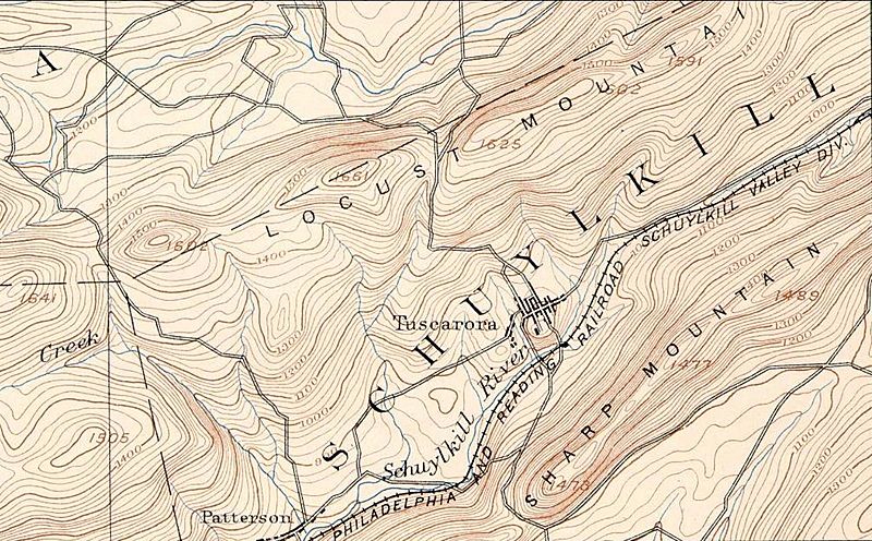
Image: Sharp Mountain NE peaks, USGS Mahanoy Pennsylvania Quadrant SE=maha92se
Size of this preview: 800 × 496 pixels. Other resolutions: 320 × 198 pixels | 1,262 × 782 pixels.
Original image (1,262 × 782 pixels, file size: 261 KB, MIME type: image/jpeg)
Description: Cut down excerpt of 15 minute series USGS Hazelton Quadrant Map This map show the region just east of Tamaqua, Pennsylvania where the East Tip of Sharp Mountain ends in Tamaqua Gap. related/continuation: File:Tamaqua, Pennsylvania Topography USGS Hazleton Quadrant Map of 1893= hzlt93sw.jpg
Title: Sharp Mountain NE peaks, USGS Mahanoy Pennsylvania Quadrant SE=maha92se
Credit: PD-USGS
Author: USGS
Usage Terms: Public domain
License: Public domain
Attribution Required?: No
Image usage
The following page links to this image:

All content from Kiddle encyclopedia articles (including the article images and facts) can be freely used under Attribution-ShareAlike license, unless stated otherwise.