
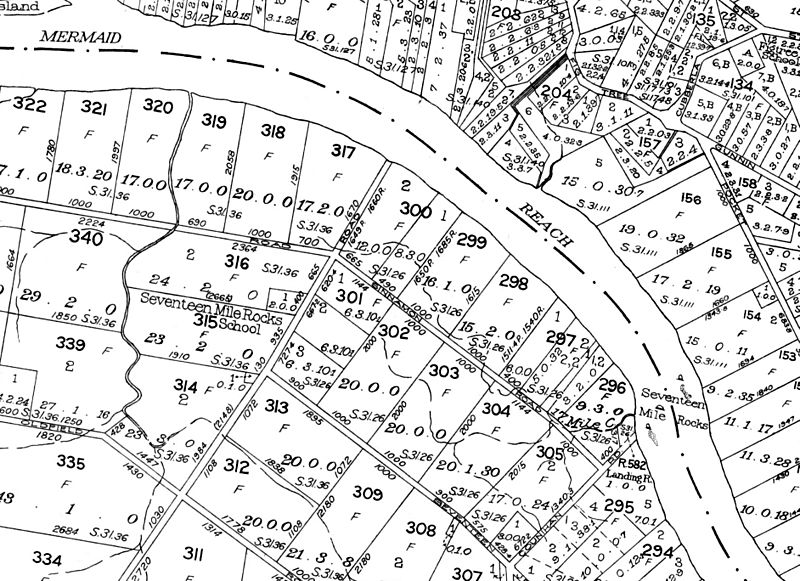
Image: Seventeen Mile Rocks, 1962

Size of this preview: 800 × 581 pixels. Other resolutions: 320 × 232 pixels | 1,883 × 1,368 pixels.
Original image (1,883 × 1,368 pixels, file size: 1.2 MB, MIME type: image/jpeg)
Description: Showing the location of the Seventeen Mile Rocks as they were in 1962 crossing the Brisbane River, before they were destroyed in the 1960 to improve the navigability of the river.
Title: Seventeen Mile Rocks, 1962
Credit: Crop of File:Cadastral map 20chain series Queensland, Sheet 2520,1962.jpg
Author: Queensland Government
Usage Terms: Public domain
License: Public domain
Attribution Required?: No
Image usage
The following page links to this image:

All content from Kiddle encyclopedia articles (including the article images and facts) can be freely used under Attribution-ShareAlike license, unless stated otherwise.