
Image: Serio-comic war map for 1877
Size of this preview: 785 × 600 pixels. Other resolutions: 314 × 240 pixels | 8,440 × 6,448 pixels.
Original image (8,440 × 6,448 pixels, file size: 13.21 MB, MIME type: image/jpeg)
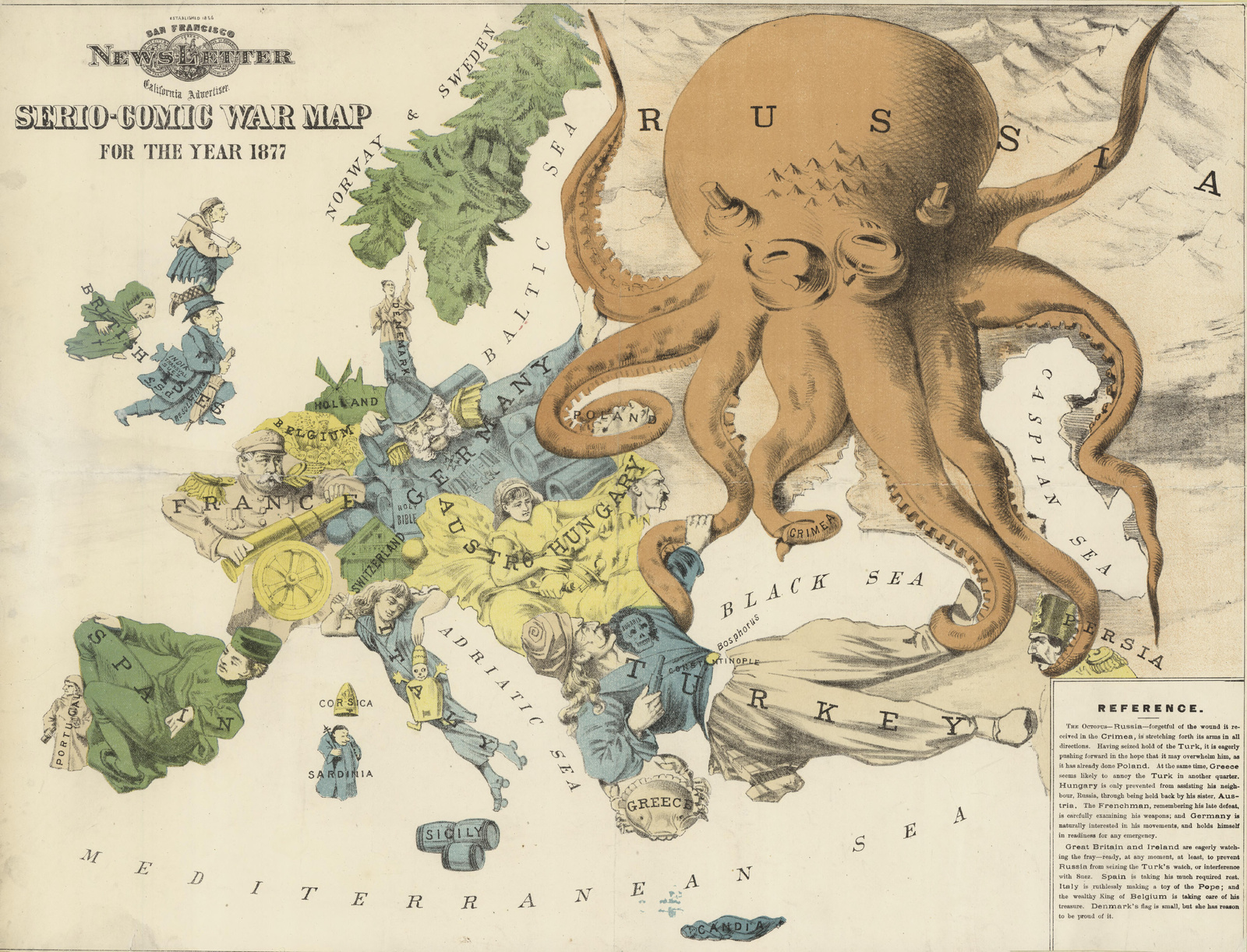
Description: Cartoon map showing the political situation in Europe in 1877.
Title: Serio-comic war map for 1877
Credit: http://nla.gov.au/nla.map-vn6289126
Author: Rose, Fred. W. (Frederick W.), artist.
Usage Terms: Public domain
License: Public domain
Attribution Required?: No
Image usage
The following page links to this image:

All content from Kiddle encyclopedia articles (including the article images and facts) can be freely used under Attribution-ShareAlike license, unless stated otherwise.