
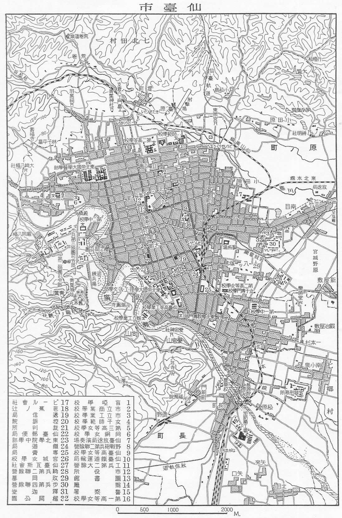
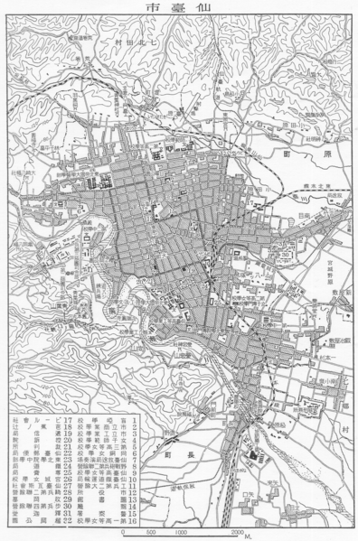
Image: Sendai map circa 1930
Size of this preview: 396 × 599 pixels. Other resolutions: 158 × 240 pixels | 1,098 × 1,661 pixels.
Original image (1,098 × 1,661 pixels, file size: 1.29 MB, MIME type: image/png)
Description: Sendai map circa 1930
Title: Sendai map circa 1930
Credit: Japanese book "Series of Japanese geography and folk culture: Vol.4" published by Shinkosha.
Author: Unknown
Usage Terms: Public domain
License: Public domain
Attribution Required?: No
Image usage
The following page links to this image:

All content from Kiddle encyclopedia articles (including the article images and facts) can be freely used under Attribution-ShareAlike license, unless stated otherwise.