
Image: Seismic hazard map around epicentre of 2010 Canterbury earthquake
No higher resolution available.
Seismic_hazard_map_around_epicentre_of_2010_Canterbury_earthquake.jpg (494 × 592 pixels, file size: 72 KB, MIME type: image/jpeg)
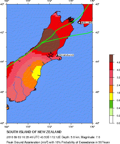
Description: Seismic hazard map for much of the South Island, New Zealand, centred on the epicentre of the 2010 Canterbury earthquake. Shows the peak ground acceleration with 10% chance of being exceeded in 50 years.
Title: Seismic hazard map around epicentre of 2010 Canterbury earthquake
Credit: http://neic.usgs.gov/neis/eq_depot/2010/eq_100903_atbj/neic_atbj_w.html
Author: Global Seismic Hazard Assessment Program, U.S. Geological Survey
Usage Terms: Public domain
License: Public domain
Attribution Required?: No
Image usage
The following page links to this image:

All content from Kiddle encyclopedia articles (including the article images and facts) can be freely used under Attribution-ShareAlike license, unless stated otherwise.