
Image: Secessionville Battlefield South Carolina
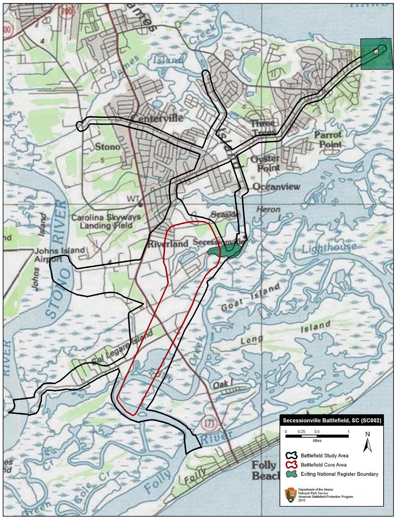
Description: Map of battlefield core and study areas. The ABPP significantly revised the 1993 Study Area and included the routes taken by Confederate reinforcements marching from Charleston and Fort Johnson to help repulse the Federal assault on Tower Battery/Fort Lamar. The width of existing Federal approaches was reduced to highlight the roads used by US troops moving through the otherwise impassible, swampy terrain of James Island. Also included is the approach route of US naval forces travelling up Folly River Creek. The expanded Core Area includes the US naval bombardment from Folly River Creek and the Confederate counter attack north of Fort Lamar.
Title: Secessionville Battlefield South Carolina
Credit: National Park Service
Author: American Battlefield Protection Program
Usage Terms: Public domain
License: Public domain
Attribution Required?: No
Image usage
The following page links to this image:
