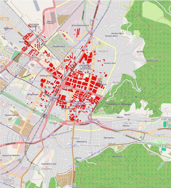
Image: Schadenskarte Operation Tigerfish 27.11.1944

Size of this preview: 546 × 599 pixels. Other resolutions: 219 × 240 pixels | 1,136 × 1,247 pixels.
Original image (1,136 × 1,247 pixels, file size: 670 KB, MIME type: image/png)
Description: amage map of operation tigerfish 27th november 1944. Totally destroyed areas are marked red. Map is based on Map M14 Nr. 89 cityarchive Freiburg. This map may be incomplete, and may contain errors. Don't rely solely on it
Title: Schadenskarte Operation Tigerfish 27.11.1944
Credit: Own work
Author: Dr. med. Mabuse
Usage Terms: Creative Commons Attribution-Share Alike 3.0
License: CC BY-SA 3.0
License Link: https://creativecommons.org/licenses/by-sa/3.0
Attribution Required?: Yes
Image usage
The following page links to this image:

All content from Kiddle encyclopedia articles (including the article images and facts) can be freely used under Attribution-ShareAlike license, unless stated otherwise.
