
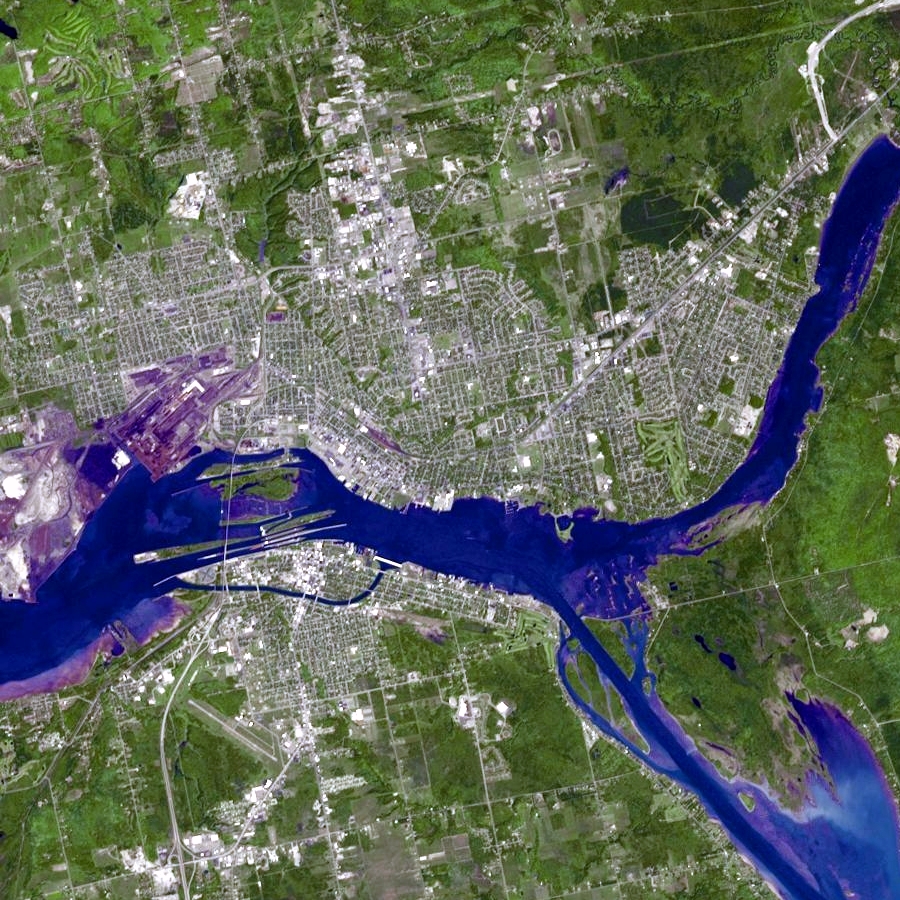
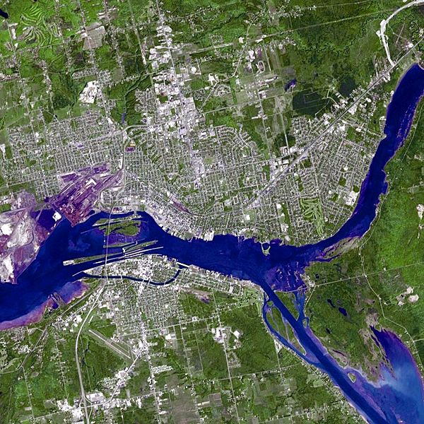
Image: Sault Ste. Marie satellite
Size of this preview: 600 × 600 pixels. Other resolutions: 240 × 240 pixels | 900 × 900 pixels.
Original image (900 × 900 pixels, file size: 735 KB, MIME type: image/jpeg)
Description: Satellite image of the St. Marys River — in Michigan (U.S.) and Ontario (Canada). Showing Sault Ste. Marie, Michigan with the active Soo Locks; and Sault Ste. Marie, Ontario with the historic Sault Ste. Marie Canal. NASA image taken on 10 June 2007
Title: Sault Ste. Marie satellite
Credit: NASA/GSFC/METI/ERSDAC/JAROS and U.S./Japan ASTER Science Team
Author: NASA
Usage Terms: Public domain
License: Public domain
Attribution Required?: No
Image usage
The following 2 pages link to this image:

All content from Kiddle encyclopedia articles (including the article images and facts) can be freely used under Attribution-ShareAlike license, unless stated otherwise.