
Image: Santa Cruz de Tenerife-Distritos 2005

Size of this PNG preview of this SVG file: 600 × 600 pixels. Other resolution: 240 × 240 pixels.
Original image (SVG file, nominally 800 × 800 pixels, file size: 408 KB)
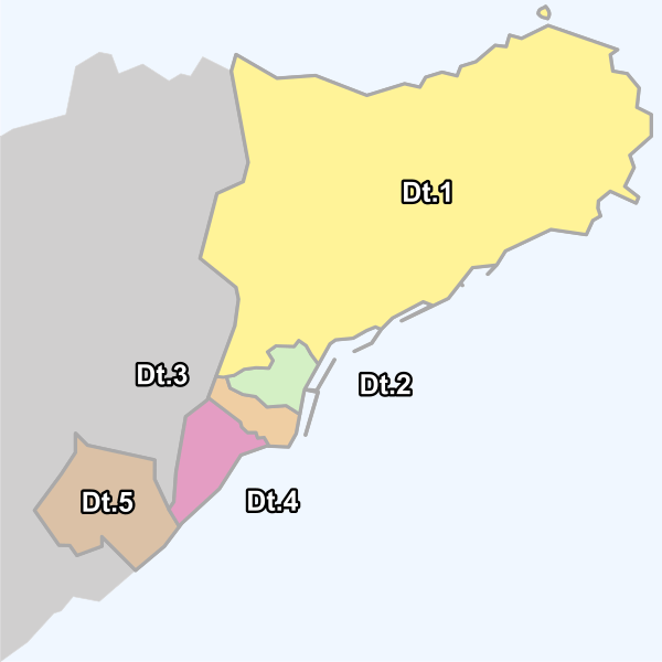
Description: Municipality of Santa Cruz de Tenerife (Tenerife), Canary Islands, Spain.
All district map locator (2005) with legend:
Dt.1= Anaga; Dt.2= Centro (center district); Dt.3= Salud-La Salle; Dt.4= Ofra-Costa Sur; Dt.5= Suroeste (southwest district).
Author: Pepelopex
Usage Terms: Creative Commons Attribution-Share Alike 3.0
License: CC-BY-SA-3.0
License Link: http://creativecommons.org/licenses/by-sa/3.0/
Attribution Required?: Yes
Image usage
The following page links to this image:

All content from Kiddle encyclopedia articles (including the article images and facts) can be freely used under Attribution-ShareAlike license, unless stated otherwise.