
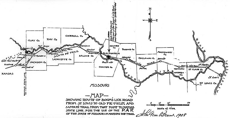
Image: Santa-fe-trail-boonslick-trail-map-1908

Size of this preview: 800 × 410 pixels. Other resolutions: 320 × 164 pixels | 2,000 × 1,026 pixels.
Original image (2,000 × 1,026 pixels, file size: 136 KB, MIME type: image/jpeg)
Description: 1908 Map of the Boon's Lick Trail across Missouri, created by John William Brunt for use by the Daughters of the American Revolution. DAR used the map to mark the route through Missouri with stone monuments.
Title: Santa-fe-trail-boonslick-trail-map-1908
Credit: State Historical Society of Missouri Map Collection, Map 850 B838 1908 https://digital.shsmo.org/digital/collection/Maps/id/49/rec/1
Author: John Wm. Brunt
Usage Terms: Public domain
License: Public domain
Attribution Required?: No
Image usage
The following page links to this image:

All content from Kiddle encyclopedia articles (including the article images and facts) can be freely used under Attribution-ShareAlike license, unless stated otherwise.