
Image: Sanborn 1895 Cotton Expo
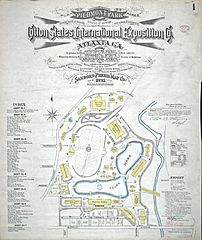
Size of this preview: 504 × 599 pixels. Other resolutions: 202 × 240 pixels | 4,513 × 5,365 pixels.
Original image (4,513 × 5,365 pixels, file size: 6.44 MB, MIME type: image/jpeg)
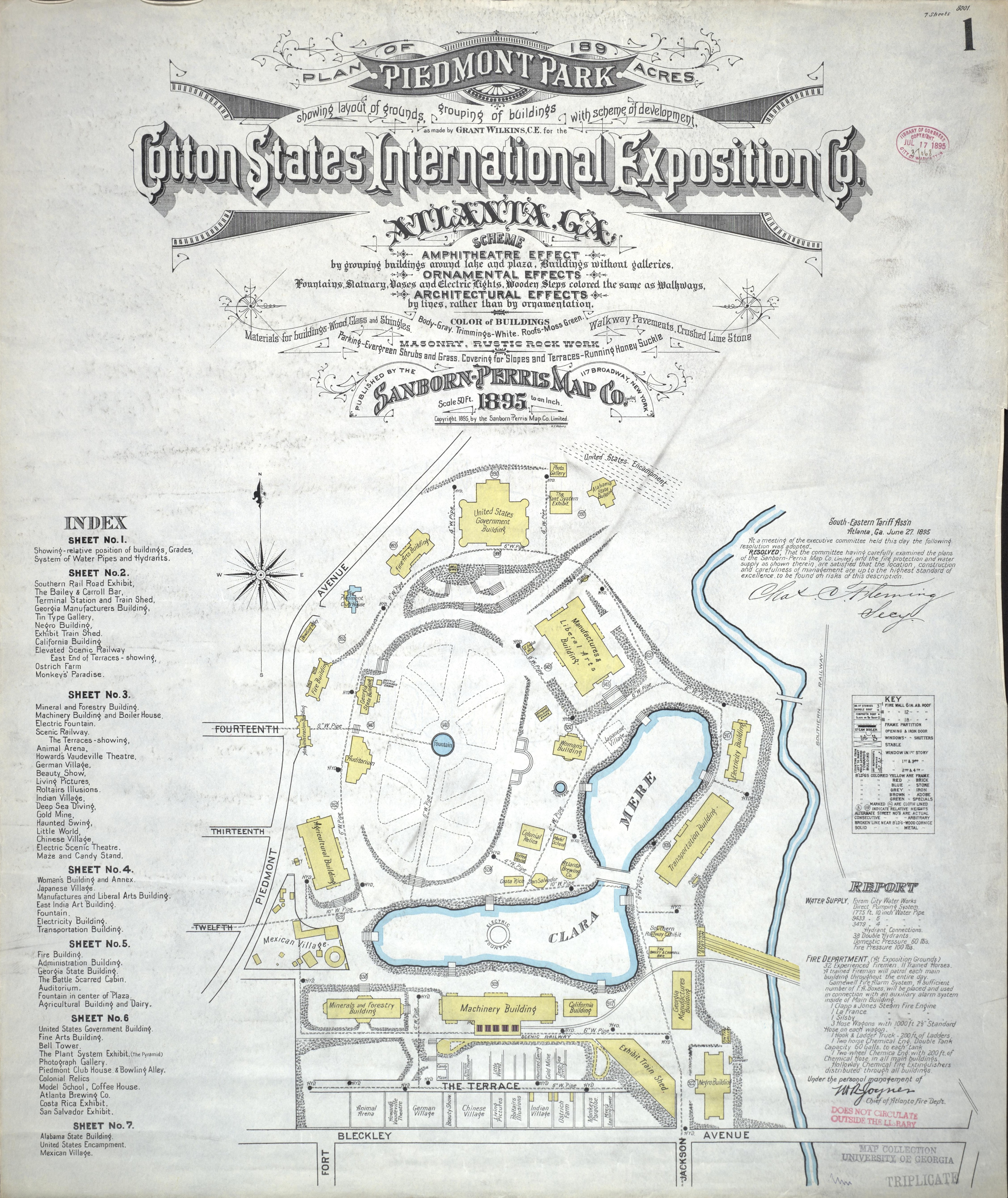
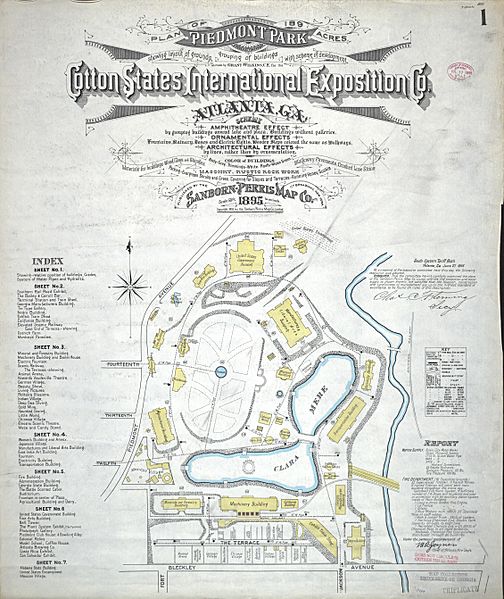
Description: Sanborn-Perris Map showing the layout of grounds, grouping of buildings with scheme of development of Piedmont Park for the 1895 Cotton States And International Exposition, Atlanta, GA. The map was lithographically printed and hand colored with the aid of wax paper stencils.
Title: Sanborn 1895 Cotton Expo
Credit: Digital Library of Georgia http://dlg.galileo.usg.edu/sanborn/CityCounty/Atlanta1895/IndexMap.html
Author: Grant Wilkins, published by the Sanborn-Perris Map Company Limited
Usage Terms: Public domain
License: Public domain
Attribution Required?: No
Image usage
The following 2 pages link to this image:

All content from Kiddle encyclopedia articles (including the article images and facts) can be freely used under Attribution-ShareAlike license, unless stated otherwise.