
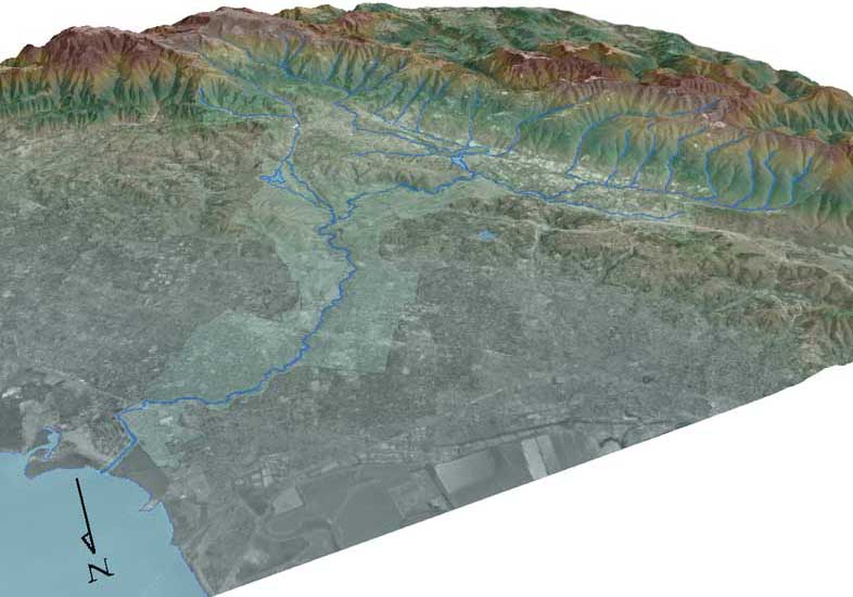
Image: San Francisquito Watershed Satellite Map USGS
No higher resolution available.
San_Francisquito_Watershed_Satellite_Map_USGS.jpg (786 × 550 pixels, file size: 77 KB, MIME type: image/jpeg)
Description: 3-D image of San Francisquito Creek watershed with mainstem and tributary creeks in blue
Title: San Francisquito Watershed Satellite Map USGS
Credit: United States Geological Survey
Author: USGS
Usage Terms: Public domain
License: Public domain
Attribution Required?: No
Image usage
The following page links to this image:

All content from Kiddle encyclopedia articles (including the article images and facts) can be freely used under Attribution-ShareAlike license, unless stated otherwise.