Image: SanFranciscoPeaks.ASTER,20031021
SanFranciscoPeaks.ASTER,20031021.jpg (540 × 405 pixels, file size: 67 KB, MIME type: image/jpeg)
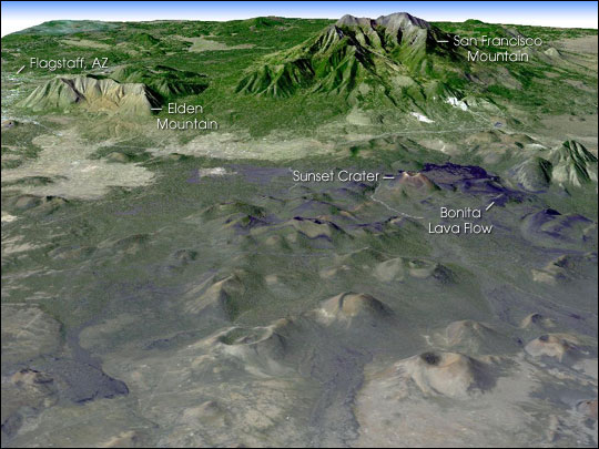
Description: Composite satellite image of the w:San Francisco Peaks, Arizona, USA. w:ASTER image data were draped over topographic data from the U.S. Geological Survey. The picture is oriented as if you were looking generally westward. The image is centered near 35.3 degrees north latitude and 111.5 degrees west longitude.
Title: SanFranciscoPeaks.ASTER,20031021
Credit: http://earthobservatory.nasa.gov/Newsroom/NewImages/images.php3?img_id=17283
Author: NASA/GSFC/METI/ERSDAC/JAROS, and U.S./Japan ASTER Science Team
Permission: Public domain
Usage Terms: Public domain
License: Public domain
Attribution Required?: No
Image usage
The following page links to this image:

All content from Kiddle encyclopedia articles (including the article images and facts) can be freely used under Attribution-ShareAlike license, unless stated otherwise.

