
Image: Salt Lake City panoramic map
Size of this preview: 800 × 431 pixels. Other resolutions: 320 × 172 pixels | 21,314 × 11,473 pixels.
Original image (21,314 × 11,473 pixels, file size: 39.22 MB, MIME type: image/jpeg)
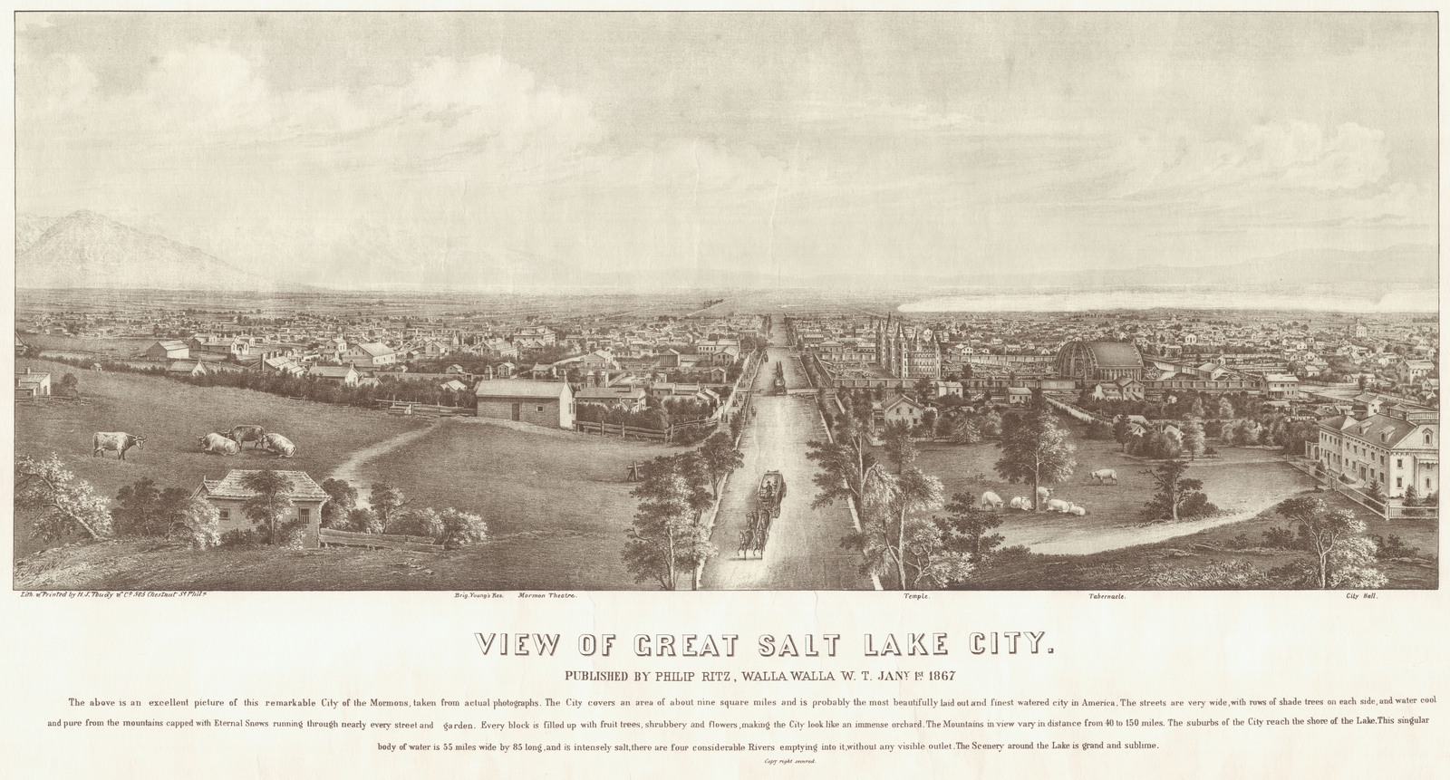
Description: Panoramic map of Salt Lake City published in 1867. Shows the Salt Lake Temple and the Salt Lake Tabernacle under construction.
Title: Salt Lake City panoramic map
Credit: Brigham Young University Harold B. Lee Library Maps Collection
Author: H.J. Toudy
Usage Terms: Public domain
License: Public domain
Attribution Required?: No
Image usage
The following page links to this image:

All content from Kiddle encyclopedia articles (including the article images and facts) can be freely used under Attribution-ShareAlike license, unless stated otherwise.