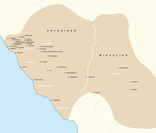
Image: Salinan map

Size of this PNG preview of this SVG file: 512 × 436 pixels. Other resolution: 282 × 240 pixels.
Original image (SVG file, nominally 512 × 436 pixels, file size: 116 KB)
Description: Map of Salinan placenames, dialects, and tribelets Sources Golla, Victor Karl. California Indian Languages. University of California Press, 2011. Jones, Terry L. et al. “An Addendum to Harrington's Northern Salinan Place Names.” (2000).[1] Northwest Economic Associates. "Ethnographic Overview of the Los Padres National Forest." (2004).[2]
Title: Salinan map
Credit: Own work
Author: Noahedits
Usage Terms: Creative Commons Attribution-Share Alike 4.0
License: CC BY-SA 4.0
License Link: https://creativecommons.org/licenses/by-sa/4.0
Attribution Required?: Yes
Image usage
The following page links to this image:

All content from Kiddle encyclopedia articles (including the article images and facts) can be freely used under Attribution-ShareAlike license, unless stated otherwise.
