
Image: Safety Harbor culture

Size of this preview: 634 × 599 pixels. Other resolutions: 254 × 240 pixels | 982 × 928 pixels.
Original image (982 × 928 pixels, file size: 10 KB, MIME type: image/png)
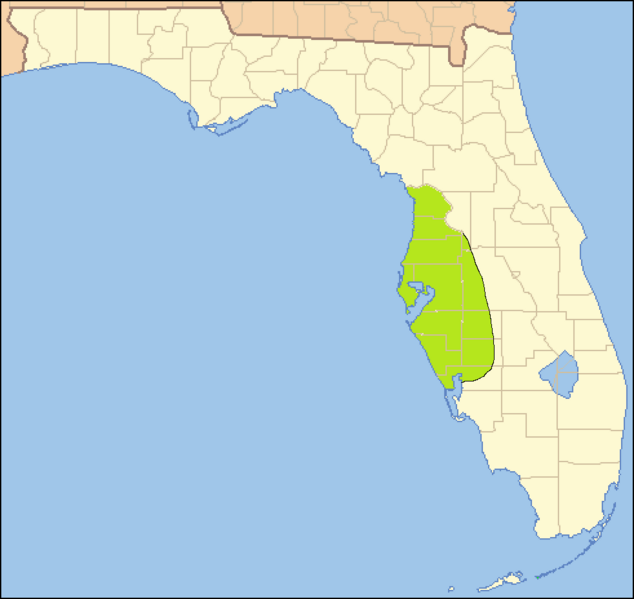
Description: Map of the approximate area of the Safety Harbor archaeological culture, based on the map on page 390 in Milanich, Jerald T. (1994). Archaeology of Precolumbian Florida. Gainesville, Florida: University Press of Florida. ISBN 0-8130-1273-2.
Title: Safety Harbor culture
Credit: taken from US Census website [1] as modified by User:Ruhrfisch at
Author: US Census, Ruhrfisch, Donald Albury
Permission: US Census / US Government work is public domain, my modifications licensed under the CC BY-SA 4.0 License
Usage Terms: Creative Commons Attribution-Share Alike 4.0
License: CC BY-SA 4.0
License Link: https://creativecommons.org/licenses/by-sa/4.0
Attribution Required?: Yes
Image usage
The following page links to this image:

All content from Kiddle encyclopedia articles (including the article images and facts) can be freely used under Attribution-ShareAlike license, unless stated otherwise.