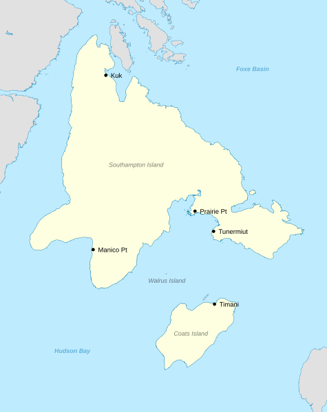
Image: Sadlermiut map

Size of this PNG preview of this SVG file: 475 × 599 pixels. Other resolution: 190 × 240 pixels.
Original image (SVG file, nominally 512 × 646 pixels, file size: 265 KB)
Description: Sources: Clark, Brenda. "The Lake Site (KkHh-2), Southampton Island, N.W.T. and Its Position in Sadlermiut Prehistory." Canadian Journal of Archaeology / Journal Canadien D’Archéologie, no. 4 (1980): 53-81. Accessed February 19, 2020. www.jstor.org/stable/41102220. Merbs, Charles F. “The Discovery and Rapid Demise of the Sadlermiut.” In Hunter-Gatherer Adaptation and Resilience: A Bioarchaeological Perspective, 302–27. Cambridge University Press, 2018. [1]
Title: Sadlermiut map
Credit: Own work
Author: Noahedits
Usage Terms: Creative Commons Attribution-Share Alike 4.0
License: CC BY-SA 4.0
License Link: https://creativecommons.org/licenses/by-sa/4.0
Attribution Required?: Yes
Image usage
The following page links to this image:

All content from Kiddle encyclopedia articles (including the article images and facts) can be freely used under Attribution-ShareAlike license, unless stated otherwise.
