
Image: Ryder's Hill - geograph.org.uk - 1181944
No higher resolution available.
Ryder's_Hill_-_geograph.org.uk_-_1181944.jpg (640 × 480 pixels, file size: 108 KB, MIME type: image/jpeg)
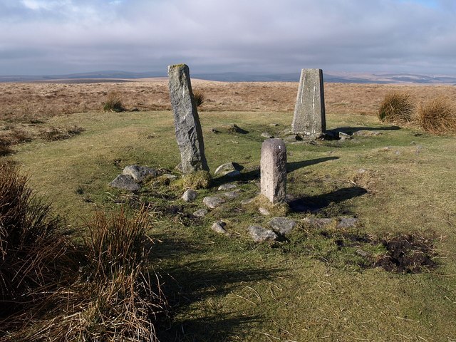
Description: Ryder's Hill. Another view of the stones on the summit of 1181943. As Butler points out, surrounding peat growth has blurred the effect of the summit cairn, but he considers it "retains its shape well, a circular platform 30 m in diameter rising to a low mound 12m across at the centre, about 1.5m above ground level" (Butler, Jeremy: Dartmoor atlas of antiquities: Vol.4, the South-East, 1993).
Title: Ryder's Hill - geograph.org.uk - 1181944
Credit: From geograph.org.uk
Author: Derek Harper
Usage Terms: Creative Commons Attribution-Share Alike 2.0
License: CC BY-SA 2.0
License Link: https://creativecommons.org/licenses/by-sa/2.0
Attribution Required?: Yes
Image usage
The following page links to this image:

All content from Kiddle encyclopedia articles (including the article images and facts) can be freely used under Attribution-ShareAlike license, unless stated otherwise.