Image: RwandaTerritoryAfterFeb1993

Size of this preview: 679 × 600 pixels. Other resolutions: 272 × 240 pixels | 2,300 × 2,032 pixels.
Original image (2,300 × 2,032 pixels, file size: 532 KB, MIME type: image/png)
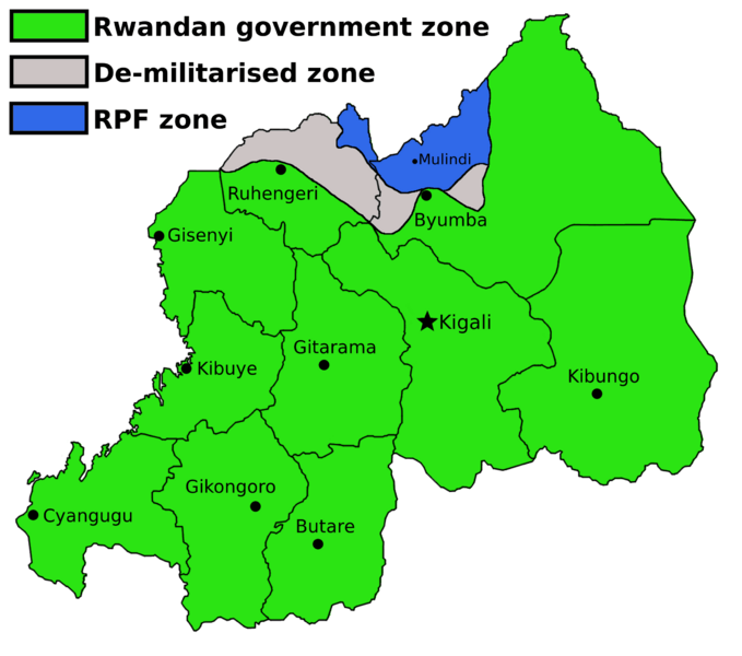
Description: The partition of Rwanda following the RPF offensive in February 1993. The green zone is the area retained by the Rwandan government, the blue is the rebel RPF held territory, and the grey zone is a de-militarized zone between the two. Source: Dallaire, Roméo (2003) Shake Hands with the Devil: The Failure of Humanity in Rwanda, London: Arrow ISBN: 978-0-09-947893-5.
Title: RwandaTerritoryAfterFeb1993
Credit: Own work
Author: Amakuru
Usage Terms: Creative Commons Attribution-Share Alike 4.0
License: CC BY-SA 4.0
License Link: https://creativecommons.org/licenses/by-sa/4.0
Attribution Required?: Yes
Image usage
The following page links to this image:

All content from Kiddle encyclopedia articles (including the article images and facts) can be freely used under Attribution-ShareAlike license, unless stated otherwise.
