
Image: Rupes Nigra
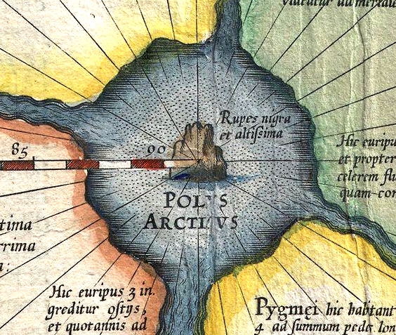
Description: Mercator: Septentrionalium Terrarum descriptio. A map of the North Pole. Detail showing “Rupes nigra et altissima”, the “black and very high rock”.
Title: Rupes Nigra
Credit: Cropped from 1606 Mercator Hondius Map of the Arctic (First Map of the North Pole) - Geographicus - NorthPole-mercator-1606.jpg.
Author: Gerardus Mercator
Permission: Public domainPublic domainfalsefalse This work is in the public domain in its country of origin and other countries and areas where the copyright term is the author's life plus 100 years or fewer. You must also include a United States public domain tag to indicate why this work is in the public domain in the United States. This file has been identified as being free of known restrictions under copyright law, including all related and neighboring rights. https://creativecommons.org/publicdomain/mark/1.0/PDMCreative Commons Public Domain Mark 1.0falsefalse
Usage Terms: Public domain
License: Public domain
Attribution Required?: No
Image usage
The following page links to this image:
