
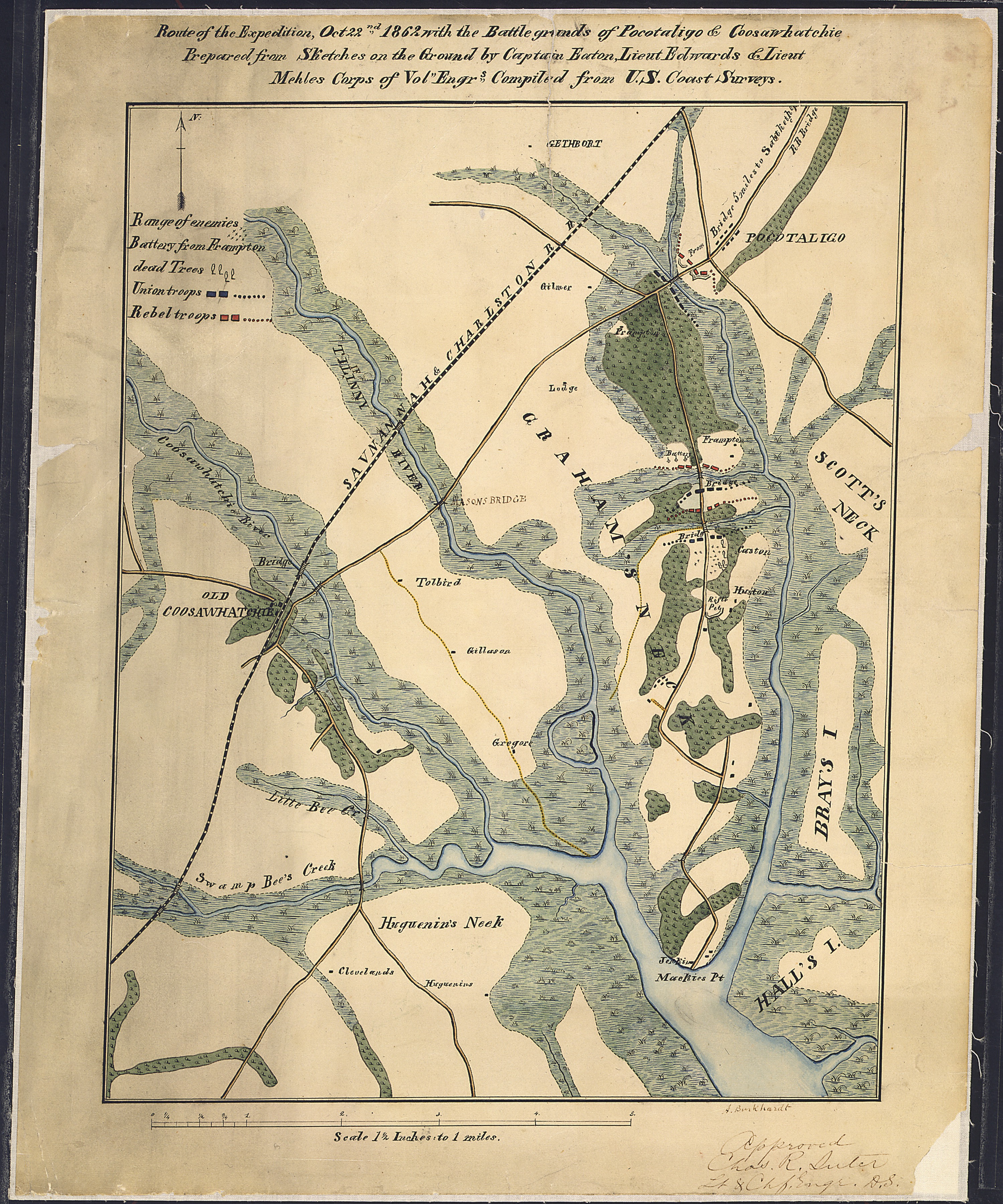
Image: Route of the Expedition, Oct. 22nd, 1862, with the Battle grounds of Pocotaligo & Coosawhatchie. Prepared form... - NARA - 305618
Size of this preview: 500 × 600 pixels. Other resolutions: 200 × 240 pixels | 3,000 × 3,600 pixels.
Original image (3,000 × 3,600 pixels, file size: 3.7 MB, MIME type: image/jpeg)
Title: Route of the Expedition, Oct. 22nd, 1862, with the Battle grounds of Pocotaligo & Coosawhatchie. Prepared form Sketches on the Ground by Captain Eaton, Lieut. Edwards & Lieut. Mehles, Corps of Vol. Engrs. Compiled from U.S. Coast Surveys
Credit: U.S. National Archives and Records Administration
Author: Unknown authorUnknown author or not provided
Usage Terms: Public domain
License: Public domain
Attribution Required?: No
Image usage
The following image is a duplicate of this image (more details):
There are no pages that link to this image.

All content from Kiddle encyclopedia articles (including the article images and facts) can be freely used under Attribution-ShareAlike license, unless stated otherwise.