
Image: Rossendale Way Footpath - geograph.org.uk - 1075652
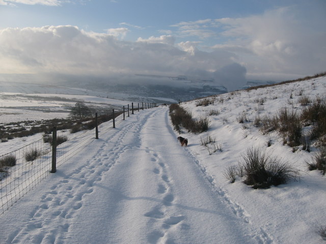
Description: Rossendale Way Footpath This footpath, covered in snow, is part of the Rossendale Way which is a 45 mile circuit walk. It takes in much of the areas history and can be broken down into 8 shorter walks from 3.5 miles to 8 miles. It is a high-level route connecting Bacup, Rawtenstall, Haslingden and Whitworth in the Rossendale Valley, crossing the open moors and farmland of the South Pennines which roughly follows the Rossendale Borough boundary. The walk is suitable for walkers of all abilities. Although not difficult, conditions underfoot can be wet and snow covered in winter so waterproof footwear is recommended. http://www.rossendale.gov.uk/tourism/site/scripts/documents_info.php?categoryID=3&documentID=343
Title: Rossendale Way Footpath - geograph.org.uk - 1075652
Credit: From geograph.org.uk
Author: Paul Anderson
Usage Terms: Creative Commons Attribution-Share Alike 2.0
License: CC BY-SA 2.0
License Link: https://creativecommons.org/licenses/by-sa/2.0
Attribution Required?: Yes
Image usage
The following page links to this image:
