
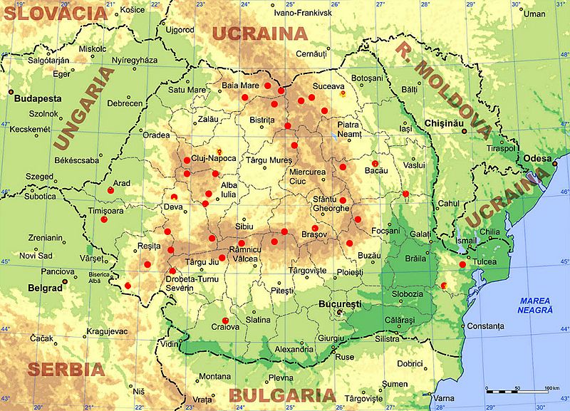
Image: Romania's Resistance 1948-1960

Size of this preview: 800 × 577 pixels. Other resolutions: 320 × 231 pixels | 1,024 × 738 pixels.
Original image (1,024 × 738 pixels, file size: 278 KB, MIME type: image/jpeg)
Description: Map locating areas of anti-communist armed resistance between 1948 and 1960 (red circles) on the physical map of Romania, in bitmap format. Orthographic map projection with center at 25 E, 46 N. Keywords: Romania, map, anti-communism, resistance movement
Title: Romania's Resistance 1948-1960
Credit: I created this map starting from the Physical map of Romania
Author: Vintila Barbu at English Wikipedia
Usage Terms: Creative Commons Attribution 2.5
License: CC BY 2.5
License Link: https://creativecommons.org/licenses/by/2.5
Attribution Required?: Yes
Image usage
The following page links to this image:

All content from Kiddle encyclopedia articles (including the article images and facts) can be freely used under Attribution-ShareAlike license, unless stated otherwise.