
Image: Roman East 50-en

Size of this PNG preview of this SVG file: 800 × 470 pixels. Other resolution: 320 × 188 pixels.
Original image (SVG file, nominally 2,717 × 1,595 pixels, file size: 848 KB)
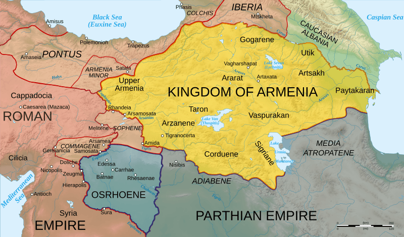
Description: Map of Armenia and the Roman client states in eastern Asia Minor, ca. 50 AD, before the Roman-Parthian War and the annexation of the client kingdoms into the Empire.
Title: Roman East 50-en
Credit: Based on Image:Arshakuni Armenia 150-en.svg. Province & client state outlines based on: Atlas of Classical History, Routledge 1985, pp. 160-162; History Map of Europe, Year 1 from Euratlas
Author: Cplakidas
Usage Terms: Creative Commons Attribution-Share Alike 3.0
License: CC BY-SA 3.0
License Link: https://creativecommons.org/licenses/by-sa/3.0
Attribution Required?: Yes
Image usage
The following 5 pages link to this image:

All content from Kiddle encyclopedia articles (including the article images and facts) can be freely used under Attribution-ShareAlike license, unless stated otherwise.