
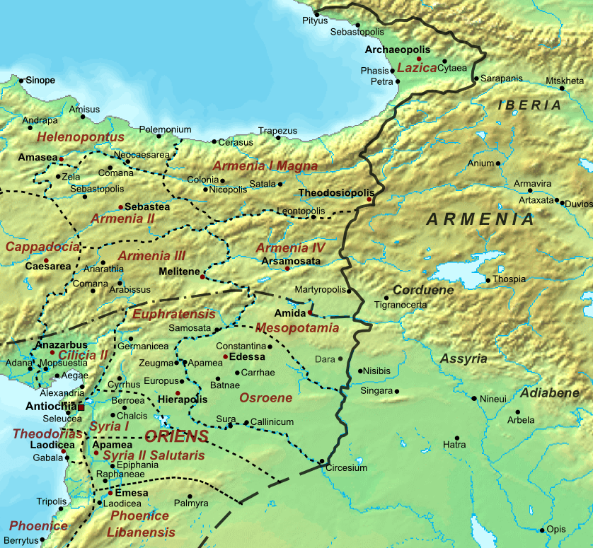
Image: Roman-Persian Frontier, 565 AD
Size of this preview: 648 × 599 pixels. Other resolutions: 260 × 240 pixels | 838 × 775 pixels.
Original image (838 × 775 pixels, file size: 344 KB, MIME type: image/png)
Description: The frontier between the Roman and Sassanid Persian Empires at the death of Emperor Justinian I in 565 AD. It includes the provincial reorganization of 536 and Lazica.
Title: Roman-Persian Frontier, 565 AD
Credit: Own work, based on another self-made Map of the Roman Empire
Author: Cplakidas
Usage Terms: Creative Commons Attribution-Share Alike 3.0
License: CC BY-SA 3.0
License Link: https://creativecommons.org/licenses/by-sa/3.0
Attribution Required?: Yes
Image usage
The following 2 pages link to this image:

All content from Kiddle encyclopedia articles (including the article images and facts) can be freely used under Attribution-ShareAlike license, unless stated otherwise.