
Image: Rohingya in Myanmar Map
No higher resolution available.
Rohingya_in_Myanmar_Map.JPG (261 × 564 pixels, file size: 16 KB, MIME type: image/jpeg)
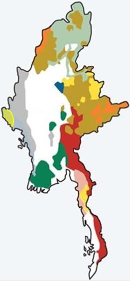
Description: The yellow striped section in the western corner shows the approximate location of the Rohingyas in Myanmar, among the country's other ethnic groups. The Rohingya area extends approximately from the western border down to the city of Sittwe.
Title: Rohingya in Myanmar Map
Credit: Own work
Author: Fatty wawa
Usage Terms: Creative Commons Attribution-Share Alike 4.0
License: CC BY-SA 4.0
License Link: http://creativecommons.org/licenses/by-sa/4.0
Attribution Required?: Yes
Image usage
The following page links to this image:

All content from Kiddle encyclopedia articles (including the article images and facts) can be freely used under Attribution-ShareAlike license, unless stated otherwise.