
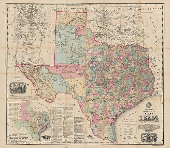
Image: Roessler Latest Map of the State of Texas 1874 UTA

Size of this preview: 692 × 600 pixels. Other resolutions: 277 × 240 pixels | 2,838 × 2,459 pixels.
Original image (2,838 × 2,459 pixels, file size: 8.37 MB, MIME type: image/jpeg)
Title: A. R. Roessler's Latest Map of the State of Texas
Credit: Cartographic Connections: map / text
Author: Anton R. Roessler
Usage Terms: Public domain
License: Public domain
Attribution Required?: No
Image usage
The following 2 pages link to this image:

All content from Kiddle encyclopedia articles (including the article images and facts) can be freely used under Attribution-ShareAlike license, unless stated otherwise.