
Image: Rocque Map of London 1746 082
Size of this preview: 415 × 599 pixels. Other resolutions: 166 × 240 pixels | 895 × 1,292 pixels.
Original image (895 × 1,292 pixels, file size: 384 KB, MIME type: image/jpeg)
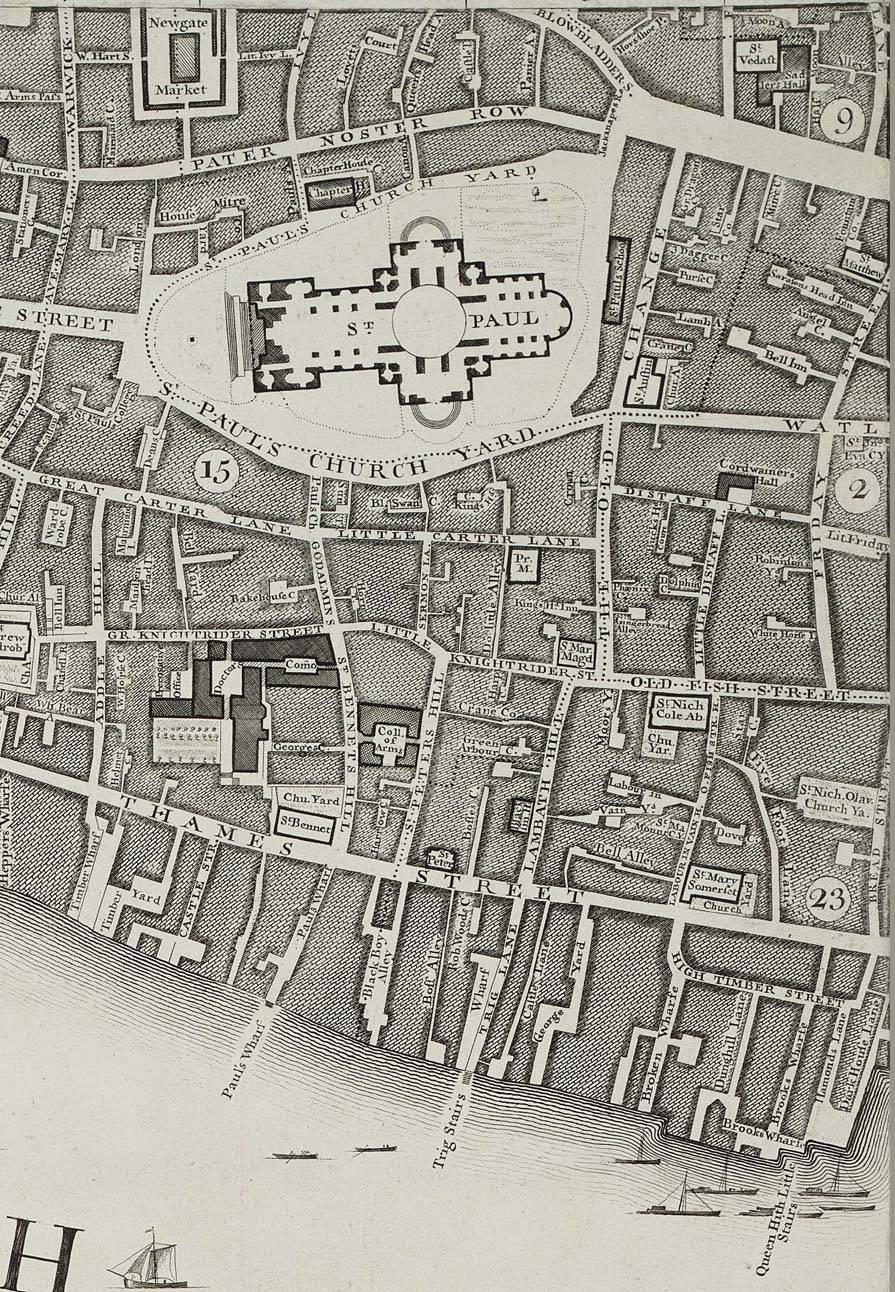
Description: John Rocque's Map of London - 1746 John Rocque's map of London was published in the form of 24 sheets at a scale of 26in. to the mile. There were eight columns of three rows, a1 to h3.
Title: Rocque Map of London 1746 082
Credit: John Rocque's 1746 Map of London
Author: John Rocque
Usage Terms: Public domain
License: Public domain
Attribution Required?: No
Image usage
The following page links to this image:

All content from Kiddle encyclopedia articles (including the article images and facts) can be freely used under Attribution-ShareAlike license, unless stated otherwise.